MyTopo
Harrells North Carolina US Topo Map
Couldn't load pickup availability
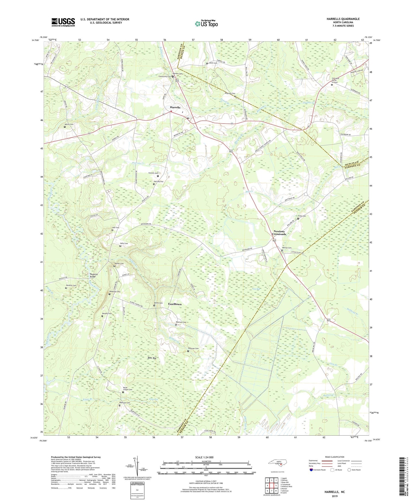
2022 topographic map quadrangle Harrells in the state of North Carolina. Scale: 1:24000. Based on the newly updated USGS 7.5' US Topo map series, this map is in the following counties: Sampson, Pender, Duplin. The map contains contour data, water features, and other items you are used to seeing on USGS maps, but also has updated roads and other features. This is the next generation of topographic maps. Printed on high-quality waterproof paper with UV fade-resistant inks.
Quads adjacent to this one:
West: Tomahawk
Northwest: Ingold
North: Delway
Northeast: Rose Hill
East: Wallace West
Southeast: Costin
South: Atkinson
Southwest: Rowan
This map covers the same area as the classic USGS quad with code o34078f2.
Contains the following named places: Alpine Church, Bear Bay, Bland High School, Boney Cemetery, Bulltail Creek, Community Cemetery, Ezzelltown, Fennell Cemetery, Fryar Cemetery, Gap Bay, Gum Branch, Hall Cemetery, Harrells, Harrells Academy, Harrells Post Office, Harrells Rescue and Emergency Medical Services, Harrells Volunteer Fire Department, Herring Cemetery, Iron Mine Burial Ground, Johnson Cemetery, Jones Cemetery, Keathern Church, Keith Branch, Kelly Cemetery, Kings Bay, Kings Branch, McMillian Cemetery, Melvin Cemetery, Murphy Cemetery, New Royal Chapel, Newkirk Cemetery, Newkirks Bridge, Newtons Crossroads, Peters Tabernacle, Peterson Cemetery, Pharisee Creek, Powell Branch, Robinson Cemetery, Roseville Church, Royal Chapel, Royal Chapel Cemetery, Seavey Cemetery, Siloam Church, Town of Harrells, Township of Franklin, Wards Chapel, Wells Chapel, Wildcat Creek, Worrell Cemetery