MyTopo
West End North Carolina US Topo Map
Couldn't load pickup availability
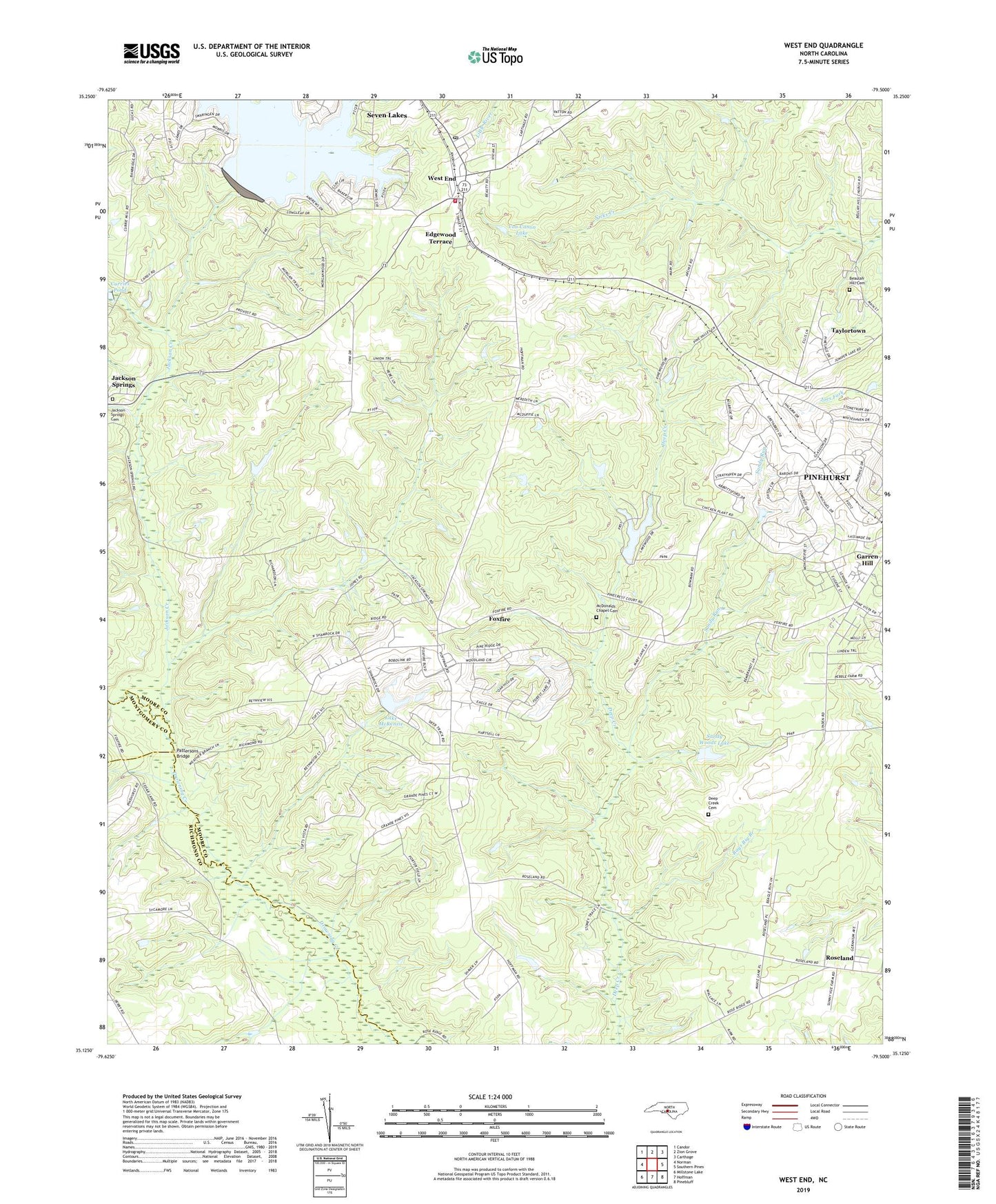
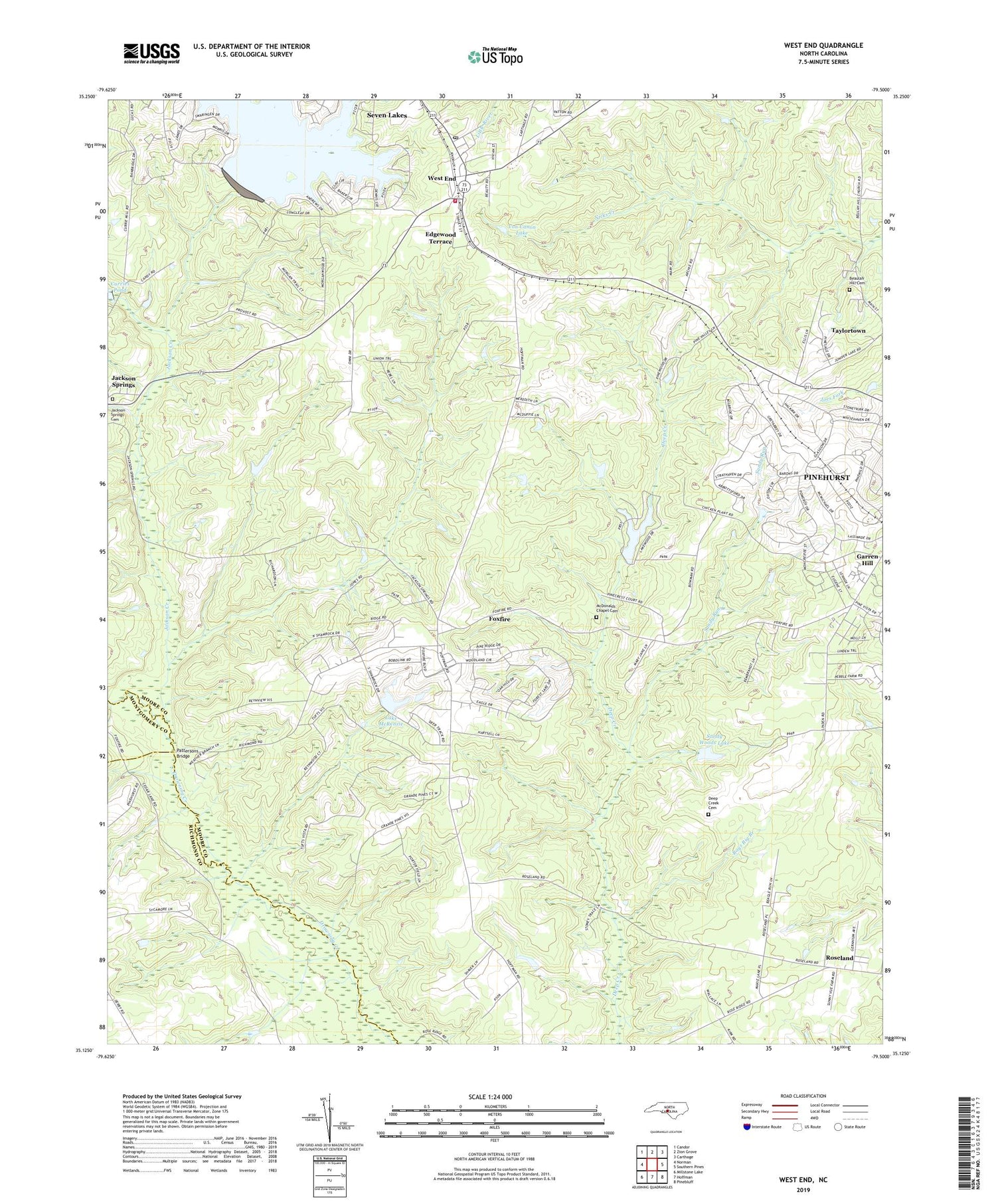
2019 topographic map quadrangle West End in the state of North Carolina. Scale: 1:24000. Based on the newly updated USGS 7.5' US Topo map series, this map is in the following counties: Moore, Richmond, Montgomery. The map contains contour data, water features, and other items you are used to seeing on USGS maps, but also has updated roads and other features. This is the next generation of topographic maps. Printed on high-quality waterproof paper with UV fade-resistant inks.
Quads adjacent to this one:
West: Norman
Northwest: Candor
North: Zion Grove
Northeast: Carthage
East: Southern Pines
Southeast: Pinebluff
South: Hoffman
Southwest: Millstone Lake
Contains the following named places: Beaulah Hill Cemetery, Beulah Hill Church, Deep Creek Cemetery, Deep Creek Church, Edgewood Terrace, Foxfire, Foxfire Country Club Airpark, Garren Hill, Jackson Creek, Jackson Springs Cemetery, Jackson Springs Presbyterian Church, Lake McKenzie, Lake McKenzie Dam, McDonalds Chapel, McDonalds Chapel Cemetery, Pattersons Bridge, Pinewood Farm, Rays Big Branch, Roseland, Roseland Church, Sandy Run, Sandy Woods Lake, Sandy Woods Lake Dam, Township 9-Mineral Springs, Village of Foxfire, Von Canon Lake, West End, West End Fire and Rescue, West End Post Office, West End Presbyterian Church, ZIP Code: 27376