MyTopo
Zion Grove North Carolina US Topo Map
Couldn't load pickup availability
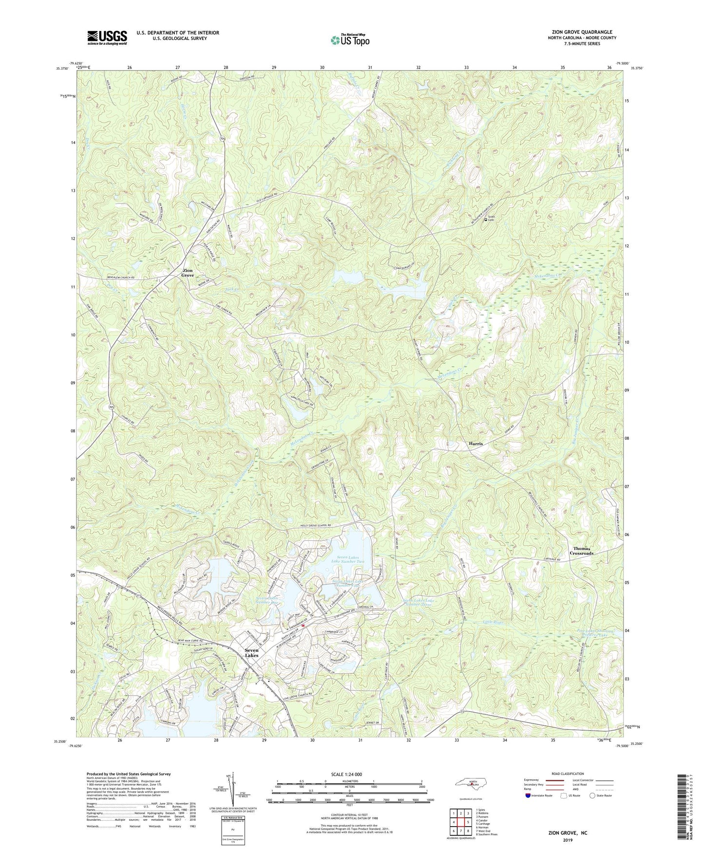
2022 topographic map quadrangle Zion Grove in the state of North Carolina. Scale: 1:24000. Based on the newly updated USGS 7.5' US Topo map series, this map is in the following counties: Moore. The map contains contour data, water features, and other items you are used to seeing on USGS maps, but also has updated roads and other features. This is the next generation of topographic maps. Printed on high-quality waterproof paper with UV fade-resistant inks.
Quads adjacent to this one:
West: Candor
Northwest: Spies
North: Robbins
Northeast: Putnam
East: Carthage
Southeast: Southern Pines
South: West End
Southwest: Norman
This map covers the same area as the classic USGS quad with code o35079c5.
Contains the following named places: Big Juniper Creek, Boy Scouts of America Dam, Cedar Grove Church, Creek Grove Church, D C Ewing Dam, Harris, Love Grove Church, Moore County Emergency Medical Services Base 3, Mount Carmel Church, Occoneechee Scout Reservation, Scott Cemetery, Seven Lakes, Seven Lakes Airport, Seven Lakes Census Designated Place, Seven Lakes Dam Number Five, Seven Lakes Dam Number Four, Seven Lakes Dam Number Three, Seven Lakes Dam Number Two, Seven Lakes Emergency Medical Services, Seven Lakes Fire Department, Seven Lakes Lake Number Five, Seven Lakes Lake Number Four, Seven Lakes Lake Number Three, Seven Lakes Lake Number Two, Seven Lakes Number One, Seven Lakes Number One Dam, Suck Creek, Thomas Crossroads, West End School, Zion Grove