
MyTopo
White Hill North Carolina US Topo Map
Couldn't load pickup availability
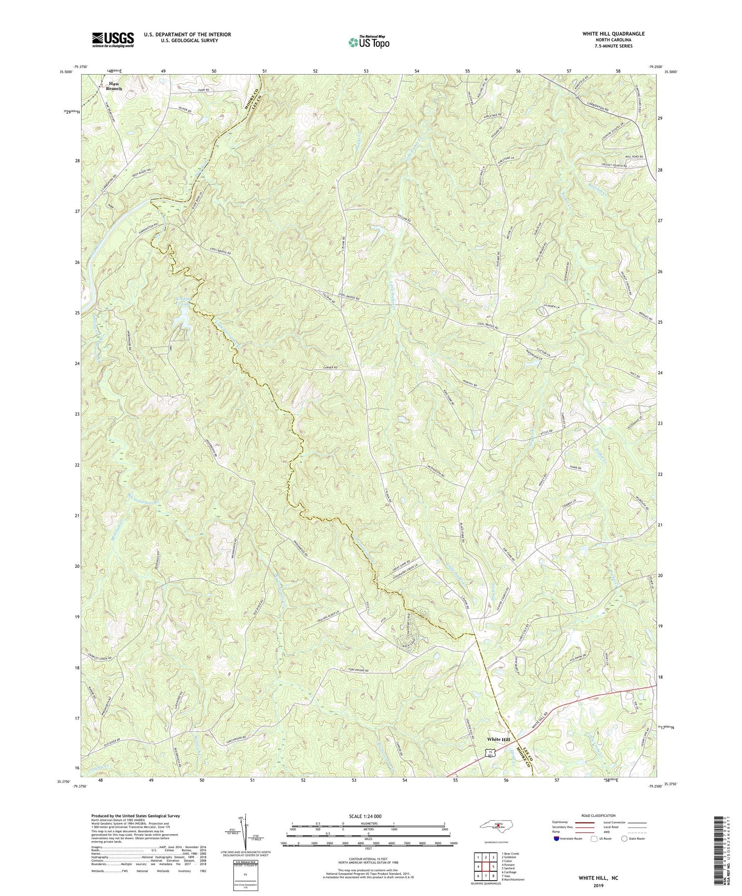
2019 topographic map quadrangle White Hill in the state of North Carolina. Scale: 1:24000. Based on the newly updated USGS 7.5' US Topo map series, this map is in the following counties: Lee, Moore. The map contains contour data, water features, and other items you are used to seeing on USGS maps, but also has updated roads and other features. This is the next generation of topographic maps. Printed on high-quality waterproof paper with UV fade-resistant inks.
Quads adjacent to this one:
West: Putnam
Northwest: Bear Creek
North: Goldston
Northeast: Colon
East: Sanford
Southeast: Murchisontown
South: Vass
Southwest: Carthage
Contains the following named places: Big Governors Creek, Carolina Forest Lake, Carolina Forest Lake Dam, Center Church, Crawley Creek, Dry Fork, Ebenezer Church, Ephesus Church, Euphronia Church, Haw Branch, Horseshoe Church, Jim Devane Dam, Little Governors Creek, McIntosh Creek, New Hope Church, Oak Grove Church, Pocket Church, Poplar Springs Church, Raccoon Creek, Red Branch Church, Township 7-Pocket, White Hill, Winding Creek Lake


