MyTopo
Bear Creek North Carolina US Topo Map
Couldn't load pickup availability
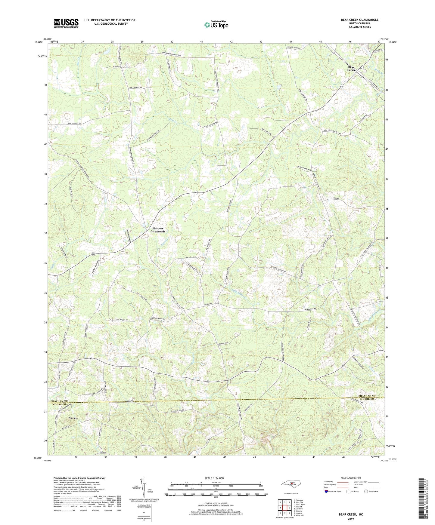
2022 topographic map quadrangle Bear Creek in the state of North Carolina. Scale: 1:24000. Based on the newly updated USGS 7.5' US Topo map series, this map is in the following counties: Chatham, Moore. The map contains contour data, water features, and other items you are used to seeing on USGS maps, but also has updated roads and other features. This is the next generation of topographic maps. Printed on high-quality waterproof paper with UV fade-resistant inks.
Quads adjacent to this one:
West: Bennett
Northwest: Coleridge
North: Siler City
Northeast: Siler City NE
East: Goldston
Southeast: White Hill
South: Putnam
Southwest: Robbins
This map covers the same area as the classic USGS quad with code o35079e4.
Contains the following named places: Alston Chapel, Antioch Church, Bear Creek, Bear Creek Church, Bear Creek Post Office, Centennial Church, Chatham Central High School, Friendly Tabernacle, Gaines Grove Church, Harpers Crossroads, Hickory Grove Church, Johnsons Crossing, New Bensalem Church, Pine Mountain, Pine Mountain Church, Providence Church, Sandy Branch, Township of Bear Creek, Tysons Creek Church, Union Chapel, ZIP Code: 27207