MyTopo
Windsor South North Carolina US Topo Map
Couldn't load pickup availability
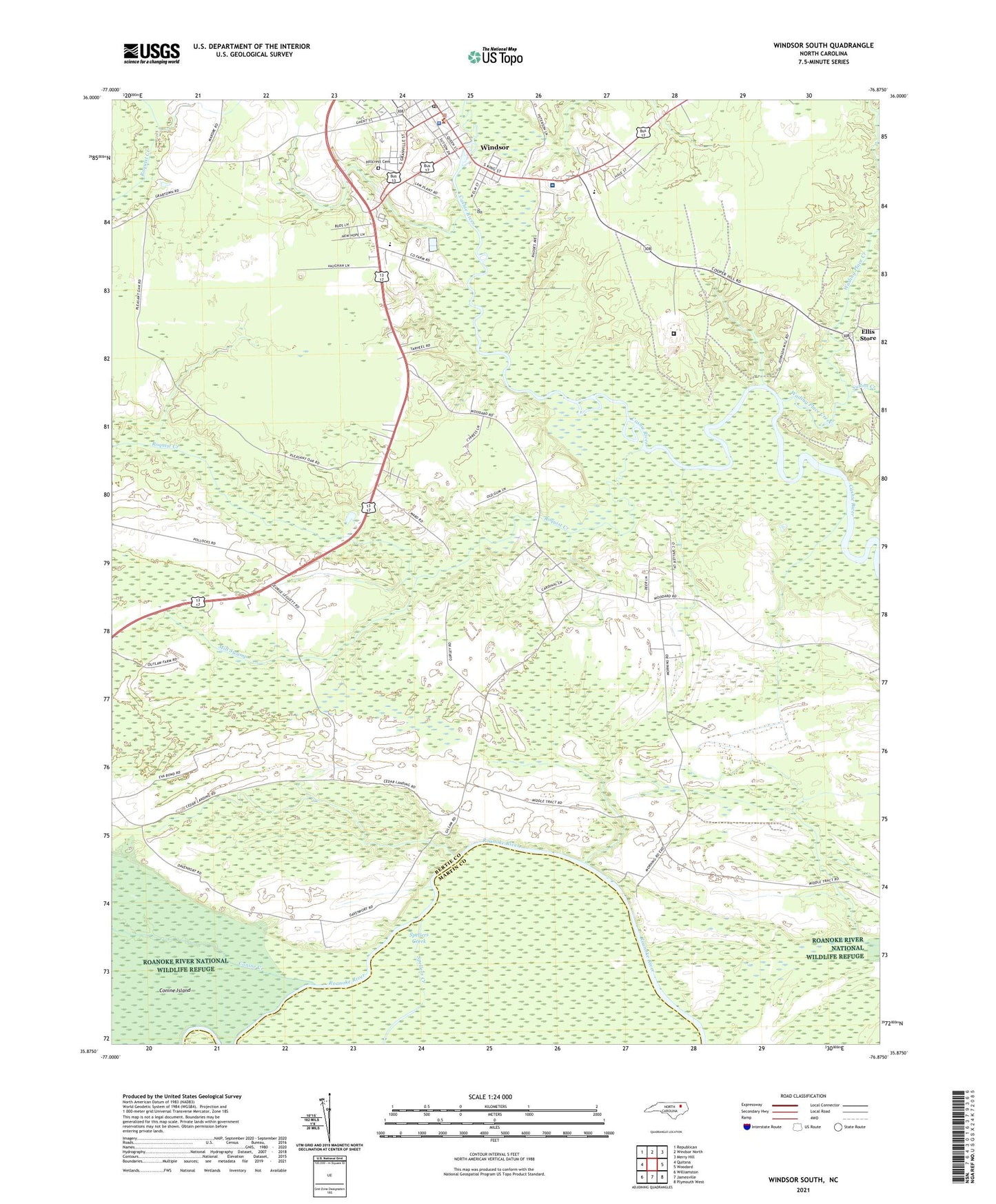
2021 topographic map quadrangle Windsor South in the state of North Carolina. Scale: 1:24000. Based on the newly updated USGS 7.5' US Topo map series, this map is in the following counties: Bertie, Martin. The map contains contour data, water features, and other items you are used to seeing on USGS maps, but also has updated roads and other features. This is the next generation of topographic maps. Printed on high-quality waterproof paper with UV fade-resistant inks.
Quads adjacent to this one:
West: Quitsna
Northwest: Republican
North: Windsor North
Northeast: Merry Hill
East: Woodard
Southeast: Plymouth West
South: Jamesville
Southwest: Williamston
Contains the following named places: Bertie Ambulance Service, Bertie Correctional Institution, Bertie County Rescue Squad, Bertie County Sheriff's Office, Bertie Martin Regional Jail, Brian Center Health and Rehabilitation of Windsor, Cedar Landing, Cedar Landing Church, Coastal Medical Transport - Windsor, Community Church, Conine Creek, Ellis Store, Faith Church, Fork Landing, Harrells Quarter, Hillcrest Cemetery, Howard Landing, Jordans Landing, Mill Swamp, Millers Store, Mooring Landing, Peace and Glory Church, Pleasant Oak Church, Robins Landing, Roquist Creek, Saint James Church, Sandy Point Church, Sutton Creek, Three Rivers Health and Rehabilitation Center, Thunderbolt Landing, Town of Windsor, Township of Windsor, Vidant Bertie Hospital, Wading Place Creek, WBTE-AM (Windsor), Windsor, Windsor Church, Windsor Police Department, Windsor Post Office, ZIP Code: 27983