MyTopo
Merry Hill North Carolina US Topo Map
Couldn't load pickup availability
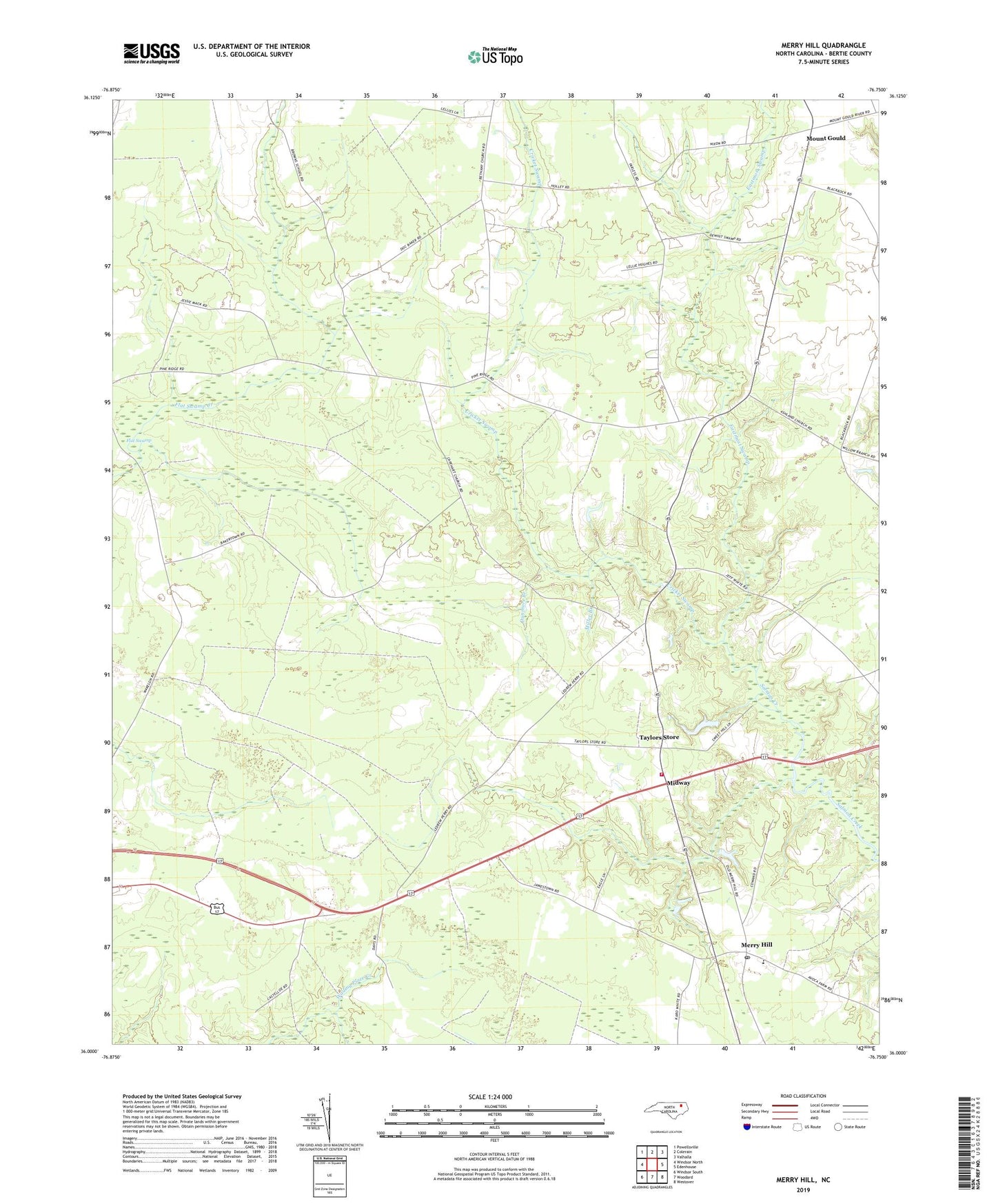
2022 topographic map quadrangle Merry Hill in the state of North Carolina. Scale: 1:24000. Based on the newly updated USGS 7.5' US Topo map series, this map is in the following counties: Bertie. The map contains contour data, water features, and other items you are used to seeing on USGS maps, but also has updated roads and other features. This is the next generation of topographic maps. Printed on high-quality waterproof paper with UV fade-resistant inks.
Quads adjacent to this one:
West: Windsor North
Northwest: Powellsville
North: Colerain
Northeast: Valhalla
East: Edenhouse
Southeast: Westover
South: Woodard
Southwest: Windsor South
This map covers the same area as the classic USGS quad with code o36076a7.
Contains the following named places: Ashland, Bloody Fork, Capeharts Church, Cricket Swamp, Dunmore Branch, Eastmost Swamp, Flat Swamp, Gregory Crossroads, Lawrence Academy, Merry - Hill Midway Volunteer Fire Department, Merry Hill, Merry Hill Post Office, Midway, Miller Branch, Mount Gould, Riverside Church, Taylors Store, Todds Airport, Township of Whites, ZIP Code: 27957