MyTopo
Anamoose SW North Dakota US Topo Map
Couldn't load pickup availability
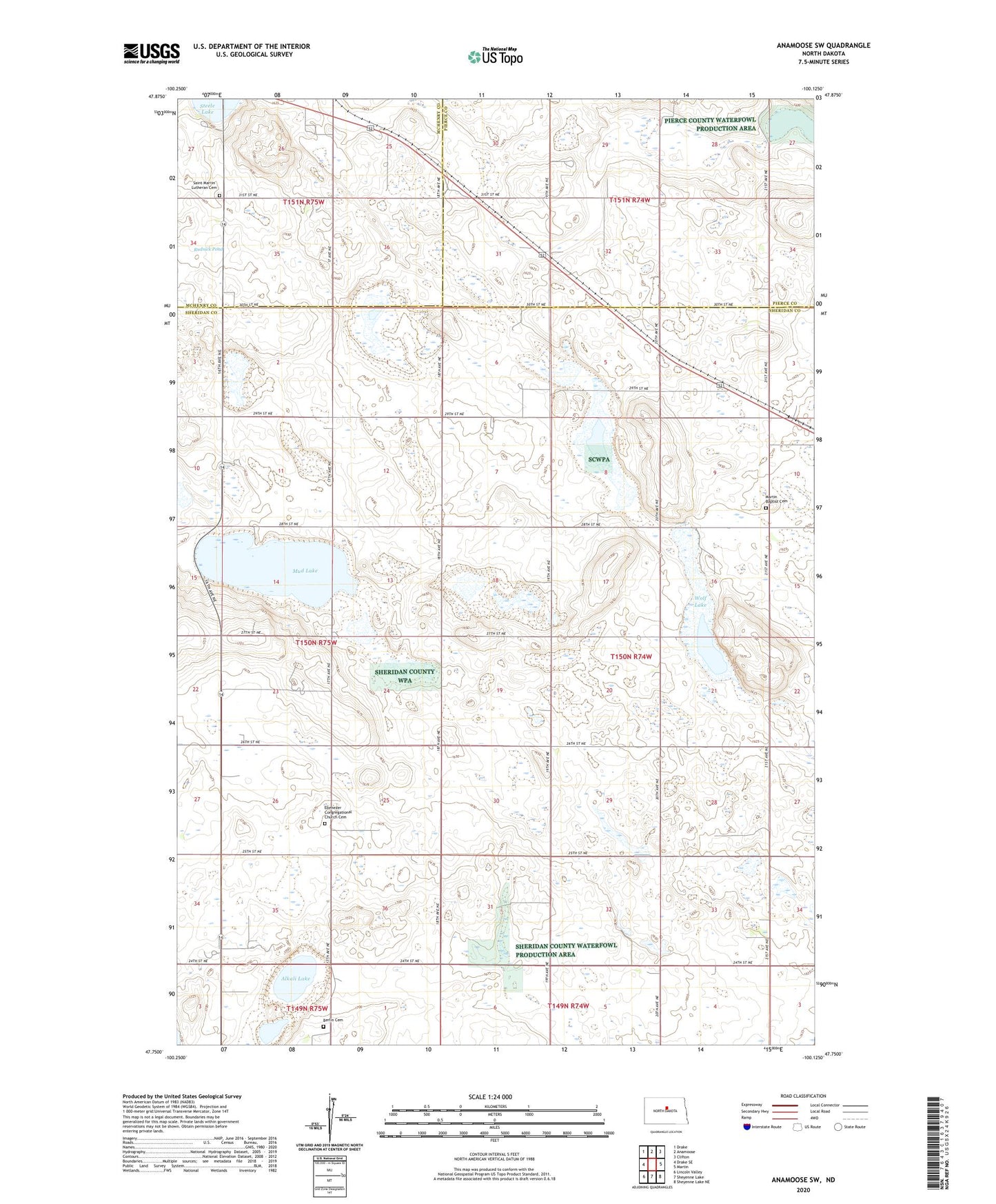
2024 topographic map quadrangle Anamoose SW in the state of North Dakota. Scale: 1:24000. Based on the newly updated USGS 7.5' US Topo map series, this map is in the following counties: Sheridan, Pierce, McHenry. The map contains contour data, water features, and other items you are used to seeing on USGS maps, but also has updated roads and other features. This is the next generation of topographic maps. Printed on high-quality waterproof paper with UV fade-resistant inks.
Quads adjacent to this one:
West: Drake SE
Northwest: Drake
North: Anamoose
Northeast: Clifton
East: Martin
Southeast: Sheyenne Lake NE
South: Sheyenne Lake
Southwest: Lincoln Valley
This map covers the same area as the classic USGS quad with code o47100g2.
Contains the following named places: Alkali Lake, Berlin Cemetery, Ebenezer Congregational Church Cemetery, Georgetown School Number 1, Georgetown School Number 4, Martin Baptist Cemetery, Mud Lake, Rudnick Pond, Saint Martin Lutheran Cemetery, Steele Lake, Township of Martin, Wolf Lake, ZIP Code: 58710