MyTopo
Ayr North Dakota US Topo Map
Couldn't load pickup availability
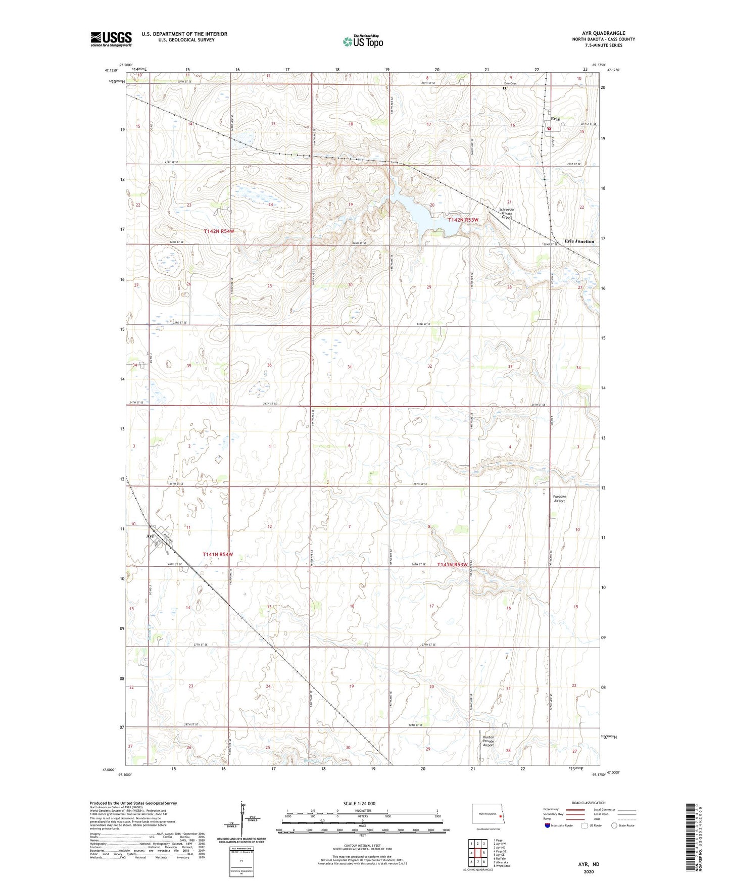
2024 topographic map quadrangle Ayr in the state of North Dakota. Scale: 1:24000. Based on the newly updated USGS 7.5' US Topo map series, this map is in the following counties: Cass. The map contains contour data, water features, and other items you are used to seeing on USGS maps, but also has updated roads and other features. This is the next generation of topographic maps. Printed on high-quality waterproof paper with UV fade-resistant inks.
Quads adjacent to this one:
West: Page SE
Northwest: Page
North: Ayr NW
Northeast: Ayr NE
East: Ayr SE
Southeast: Wheatland
South: Absaraka
Southwest: Buffalo
This map covers the same area as the classic USGS quad with code o47097a4.
Contains the following named places: Ayr, Ayr Post Office, Cass County Pioneer Village, City of Ayr, Erie, Erie Cemetery, Erie Census Designated Place, Erie Dam, Erie Junction, Erie Post Office, Erie Rural Fire Department, Pueppke Airport, Punton Private Airport, Schroeder Private Airport, Township of Empire, Township of Erie, ZIP Codes: 58007, 58029