MyTopo
Burning Mine Butte North Dakota US Topo Map
Couldn't load pickup availability
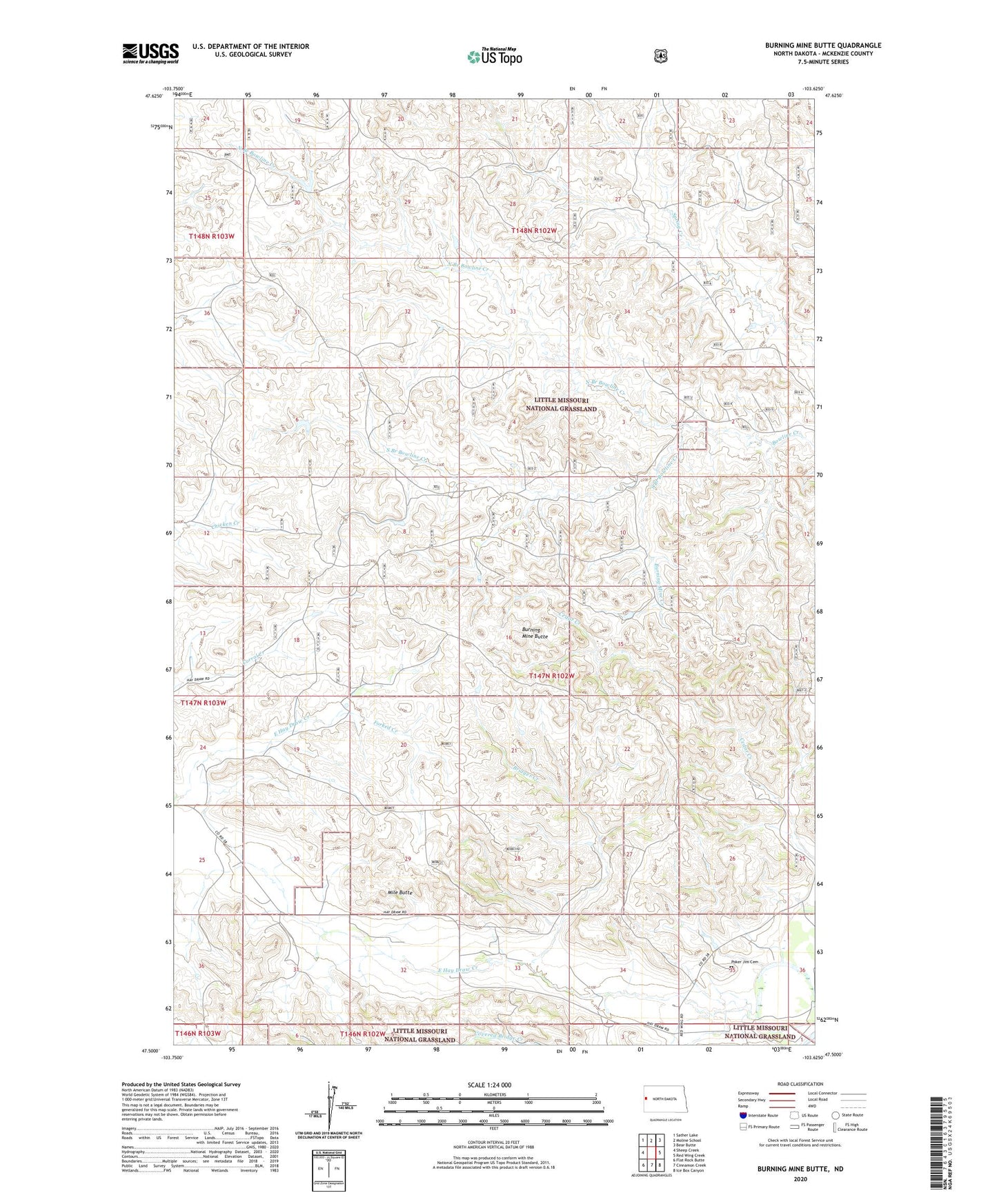
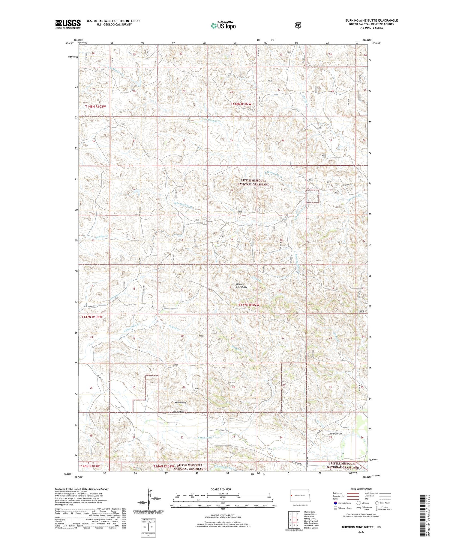
2020 topographic map quadrangle Burning Mine Butte in the state of North Dakota. Scale: 1:24000. Based on the newly updated USGS 7.5' US Topo map series, this map is in the following counties: McKenzie. The map contains contour data, water features, and other items you are used to seeing on USGS maps, but also has updated roads and other features. This is the next generation of topographic maps. Printed on high-quality waterproof paper with UV fade-resistant inks.
Quads adjacent to this one:
West: Sheep Creek
Northwest: Sather Lake
North: Moline School
Northeast: Bear Butte
East: Red Wing Creek
Southeast: Ice Box Canyon
South: Cinnamon Creek
Southwest: Flat Rock Butte
Contains the following named places: A Moe Ranch, Bridger Creek, Burning Mine Butte, Burning Mine Creek, Covered Bridge Creek, East Hay Draw Creek, Fitzgerald Ranch, Forked Creek, Hayward Dam, M Crighton Ranch, Mile Butte, North Branch Bowline Creek, Poker Jim Cemetery, South Branch Bowline Creek, Stevenson School