MyTopo
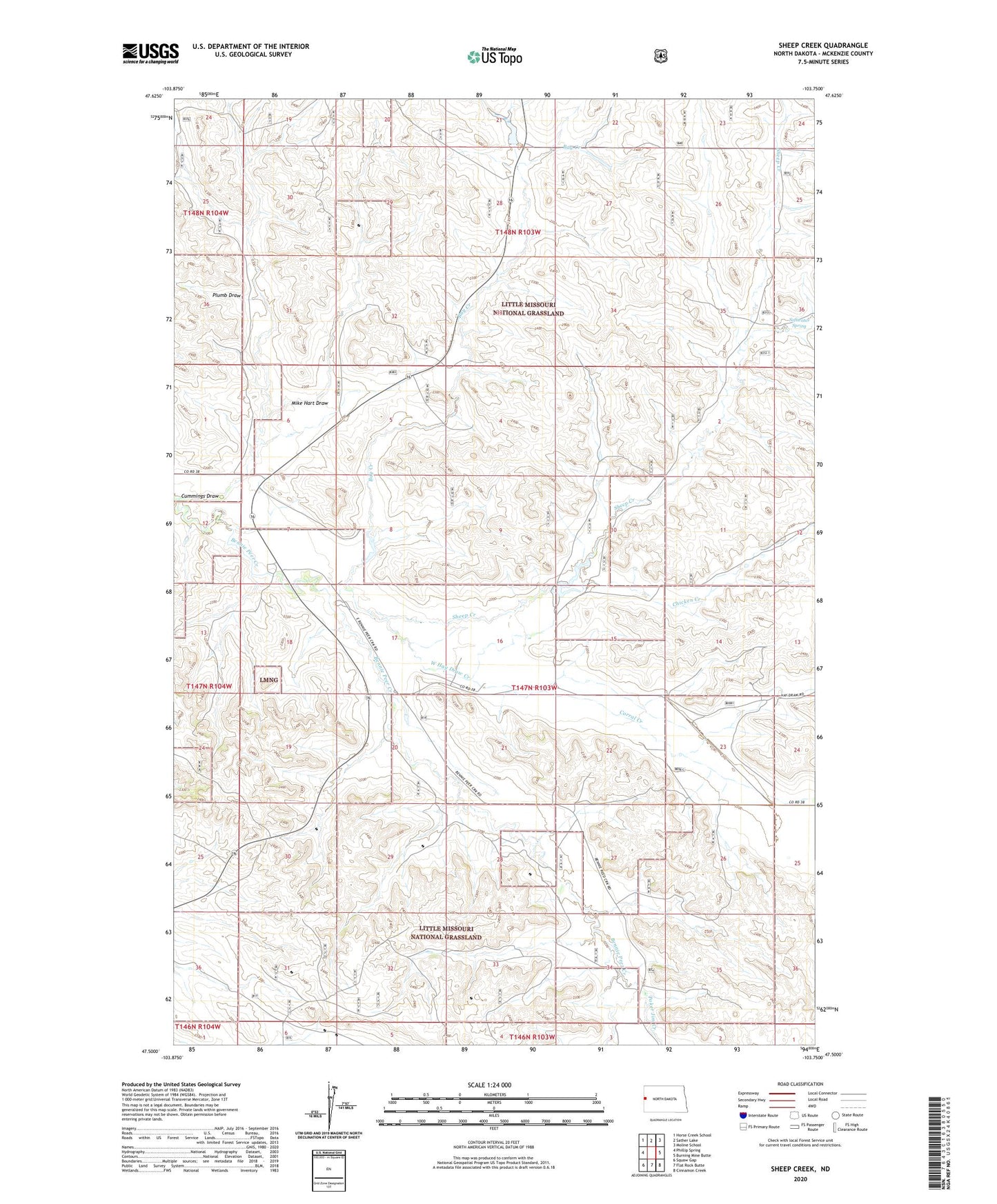
Sheep Creek North Dakota US Topo Map
Couldn't load pickup availability
Also explore the Sheep Creek Forest Service Topo of this same quad for updated USFS data
2024 topographic map quadrangle Sheep Creek in the state of North Dakota. Scale: 1:24000. Based on the newly updated USGS 7.5' US Topo map series, this map is in the following counties: McKenzie. The map contains contour data, water features, and other items you are used to seeing on USGS maps, but also has updated roads and other features. This is the next generation of topographic maps. Printed on high-quality waterproof paper with UV fade-resistant inks.
Quads adjacent to this one:
West: Phillip Spring
Northwest: Horse Creek School
North: Sather Lake
Northeast: Moline School
East: Burning Mine Butte
Southeast: Cinnamon Creek
South: Flat Rock Butte
Southwest: Squaw Gap
This map covers the same area as the classic USGS quad with code o47103e7.
Contains the following named places: Bay Creek, Burns Dam, C Erstolen Ranch, Chicken Creek, Corral Creek, Cummings Draw, H Madison Ranch, Indergard Ranch, Indergard Water Well, Leland Dam, Leland Ranch, Leland School, Mike Hart Draw, Plumb Draw, Poker Jim Creek, R Peak Ranch, Sheep Creek, Skaar Substation, Softwater Spring, Squaw Gap Substation, Unorganized Territory of Southwest McKenzie, W Lewis Ranch, West Hay Draw Creek