MyTopo
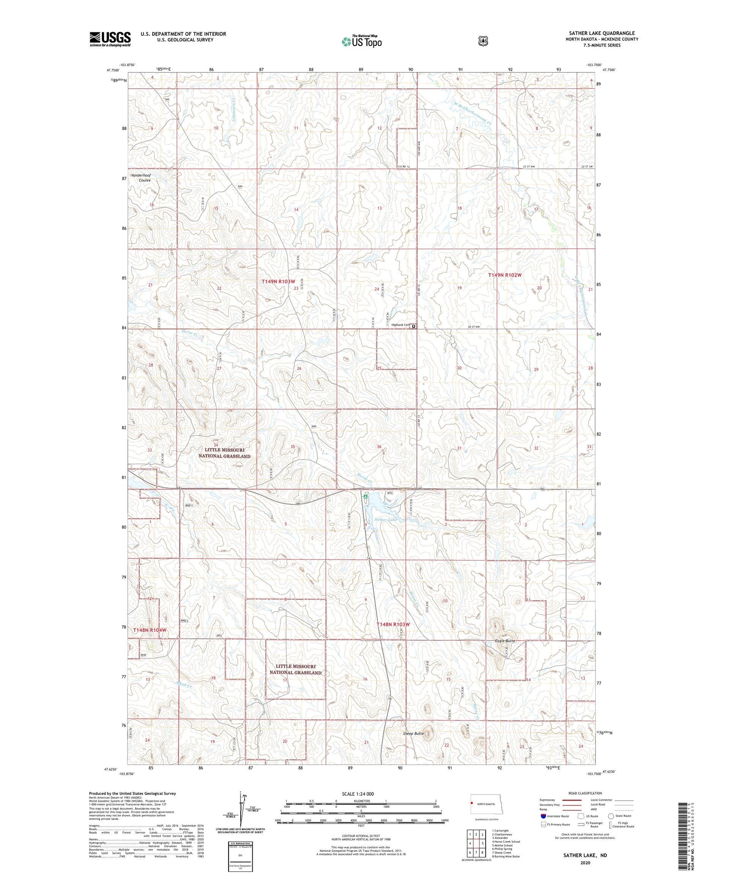
Sather Lake North Dakota US Topo Map
Couldn't load pickup availability
Also explore the Sather Lake Forest Service Topo of this same quad for updated USFS data
2024 topographic map quadrangle Sather Lake in the state of North Dakota. Scale: 1:24000. Based on the newly updated USGS 7.5' US Topo map series, this map is in the following counties: McKenzie. The map contains contour data, water features, and other items you are used to seeing on USGS maps, but also has updated roads and other features. This is the next generation of topographic maps. Printed on high-quality waterproof paper with UV fade-resistant inks.
Quads adjacent to this one:
West: Horse Creek School
Northwest: Cartwright
North: Charbonneau
Northeast: Alexander
East: Moline School
Southeast: Burning Mine Butte
South: Sheep Creek
Southwest: Phillip Spring
This map covers the same area as the classic USGS quad with code o47103f7.
Contains the following named places: B Greenwood Ranch, D Greenwood Ranch, Eagle Butte, Greenwood Headquarters Water Well, Highland Cemetery, R Anderson Ranch, Sather Campground, Sather Dam, Sather Lake, Sather Lake Recreation Area, Sather Reservoir, Severson Ranch, Sheep Butte