
MyTopo
Camp Grafton North Dakota US Topo Map
Couldn't load pickup availability
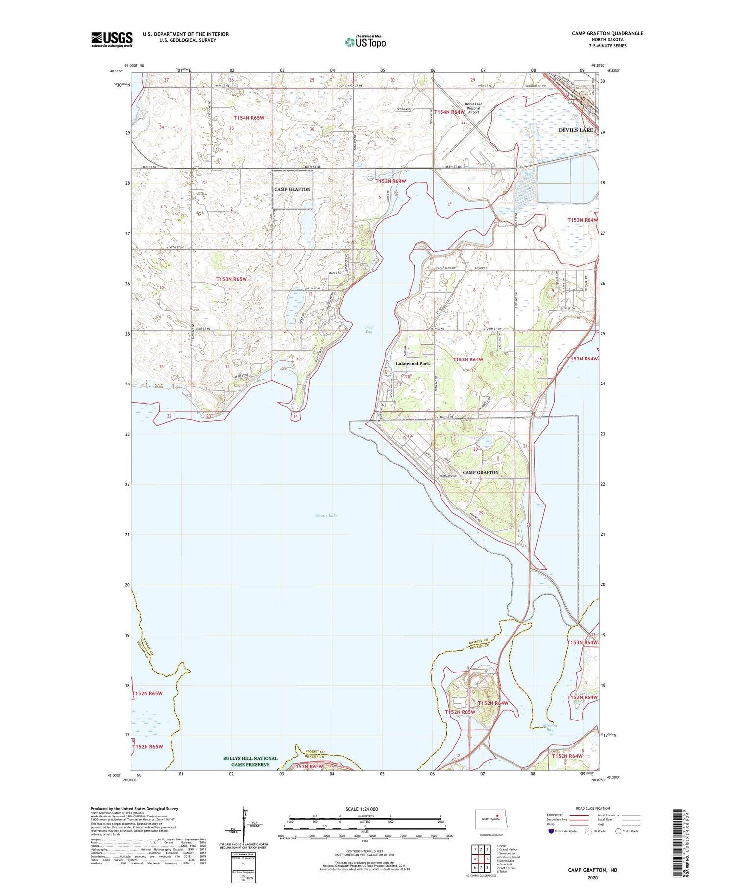
2020 topographic map quadrangle Camp Grafton in the state of North Dakota. Scale: 1:24000. Based on the newly updated USGS 7.5' US Topo map series, this map is in the following counties: Ramsey, Benson. The map contains contour data, water features, and other items you are used to seeing on USGS maps, but also has updated roads and other features. This is the next generation of topographic maps. Printed on high-quality waterproof paper with UV fade-resistant inks.
Quads adjacent to this one:
West: Grahams Island
Northwest: Penn
North: Grand Harbor
Northeast: Sweetwater
East: Devils Lake
Southeast: Tokio
South: Fort Totten
Southwest: Crow Hill
Contains the following named places: Camp Grafton, Camp Grafton Training Center, Creel Bay, Devils Lake, Devils Lake Regional Airport, Fort Totten Station, Grove School, Lakewood Park, Lakewood Park Post Office, Mission Bay, School Number 2, Spirit Lake Casino and Resort, Township of Creel, Township of Poplar Grove


