MyTopo
Crow Hill North Dakota US Topo Map
Couldn't load pickup availability
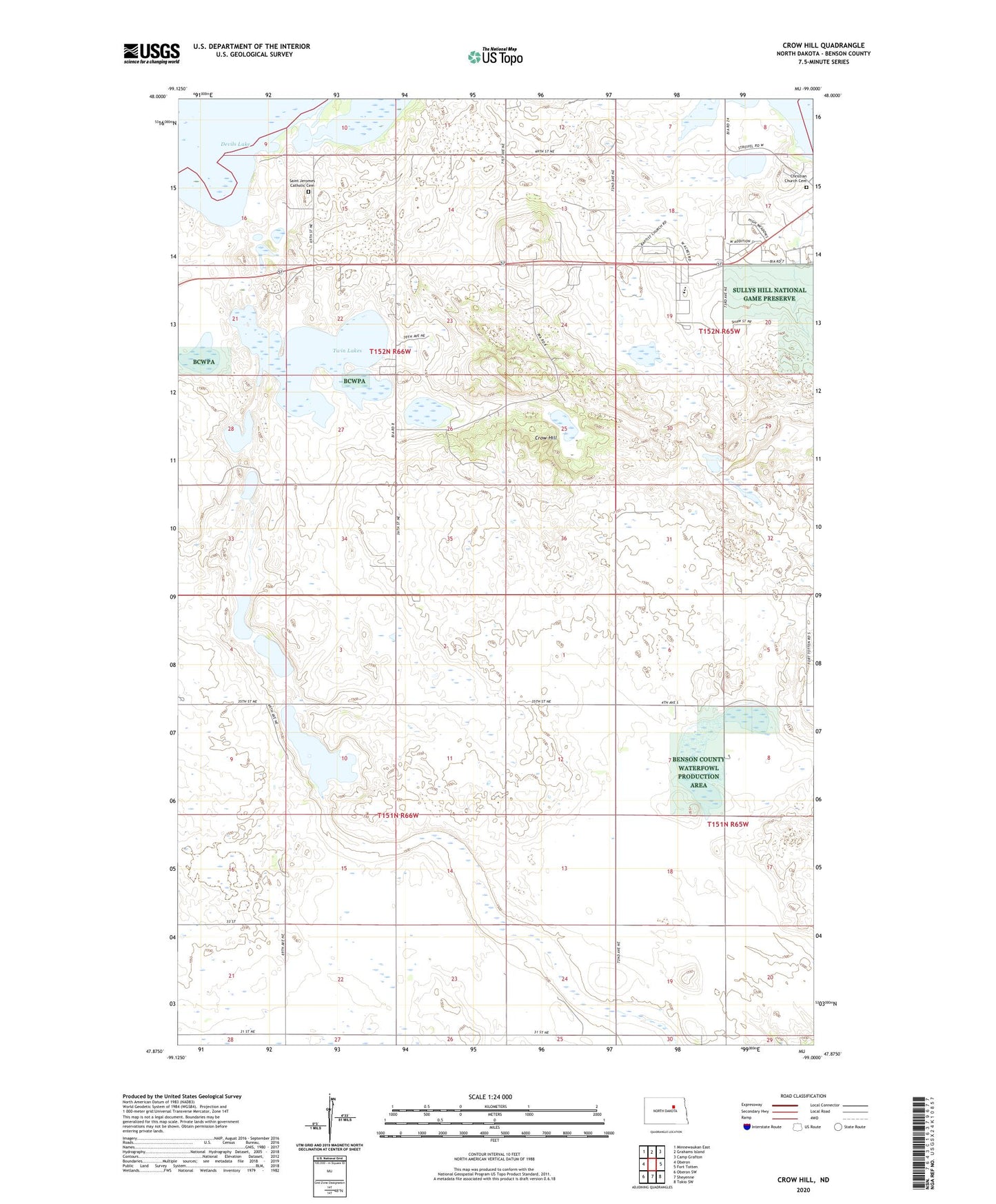
2024 topographic map quadrangle Crow Hill in the state of North Dakota. Scale: 1:24000. Based on the newly updated USGS 7.5' US Topo map series, this map is in the following counties: Benson. The map contains contour data, water features, and other items you are used to seeing on USGS maps, but also has updated roads and other features. This is the next generation of topographic maps. Printed on high-quality waterproof paper with UV fade-resistant inks.
Quads adjacent to this one:
West: Oberon
Northwest: Minnewaukan East
North: Grahams Island
Northeast: Camp Grafton
East: Fort Totten
Southeast: Tokio SW
South: Sheyenne
Southwest: Oberon SW
This map covers the same area as the classic USGS quad with code o47099h1.
Contains the following named places: Christian Church, Christian Church Cemetery, Crow Hill, Four Winds Community High School, Indian School, Lakeview School Number 2, Lone Tree School Number 2, Plainview School Number 1, Plainview School Number 2, Saint Jerome Church, Saint Jeromes Catholic Cemetery, Spirit Lake Ambulance Service, Tate Topa Tribal School, Township of Rock, Twin Lakes, ZIP Code: 58335