MyTopo
Cando North Dakota US Topo Map
Couldn't load pickup availability
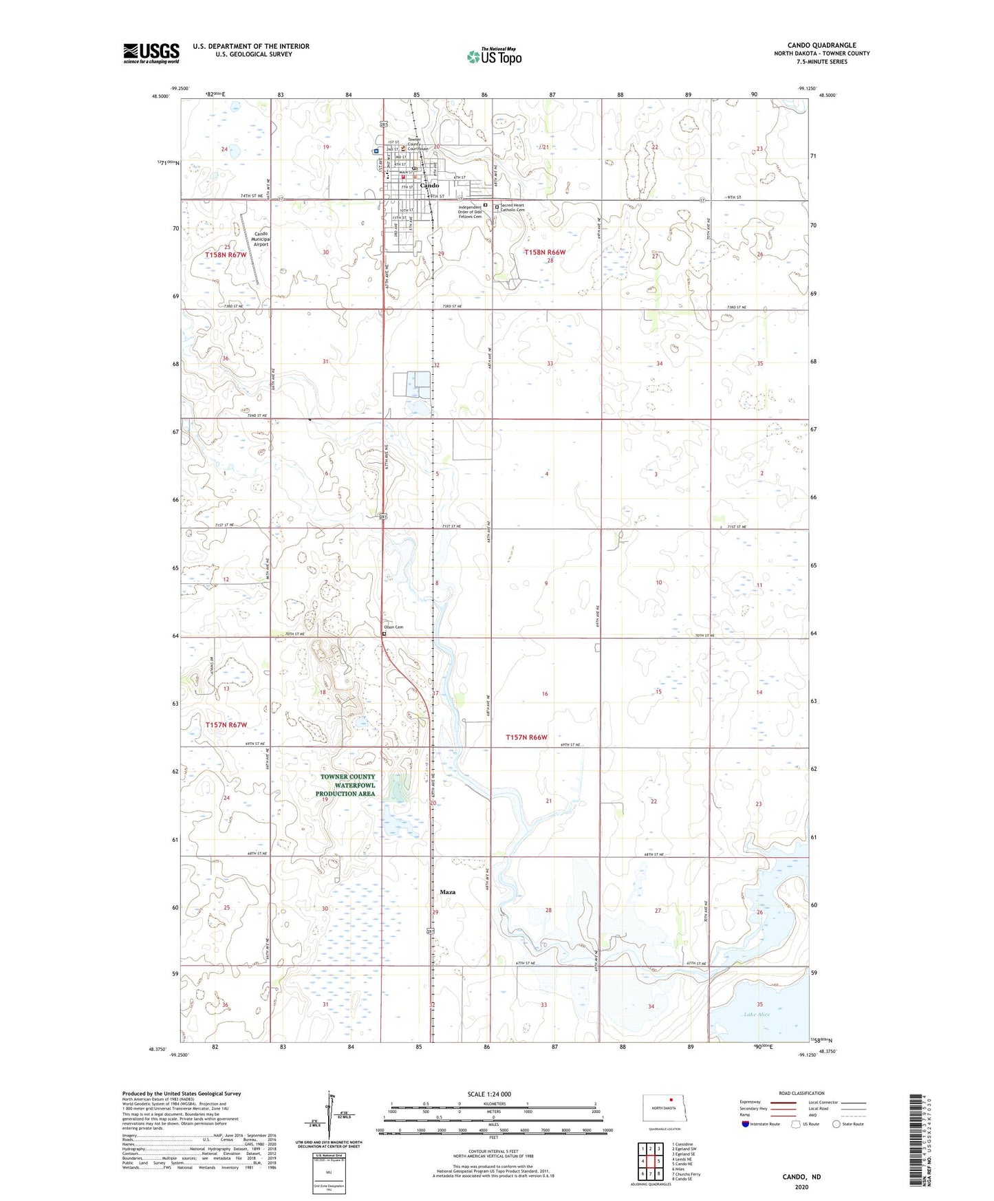
2024 topographic map quadrangle Cando in the state of North Dakota. Scale: 1:24000. Based on the newly updated USGS 7.5' US Topo map series, this map is in the following counties: Towner. The map contains contour data, water features, and other items you are used to seeing on USGS maps, but also has updated roads and other features. This is the next generation of topographic maps. Printed on high-quality waterproof paper with UV fade-resistant inks.
Quads adjacent to this one:
West: Leeds NE
Northwest: Considine
North: Egeland SW
Northeast: Egeland SE
East: Cando NE
Southeast: Cando SE
South: Churchs Ferry
Southwest: Niles
This map covers the same area as the classic USGS quad with code o48099d2.
Contains the following named places: Cando, Cando City Hall, Cando Community Library, Cando Fire Department, Cando Municipal Airport, Cando Police Department, Cando Post Office, City of Cando, City of Maza, Gopher School Number 4, Independent Order of Odd Fellows Cemetery, Johnston Polled Herefords Airstrip, Maza, North Star Public School, Olson Cemetery, Pioneer Foundation Museum, Sacred Heart Catholic Cemetery, Towner County Ambulance Service, Towner County Courthouse, Towner County Living Center, Towner County Medical Center, Towner County Sheriff's Office, Township of Maza, ZIP Code: 58324