MyTopo
Carson North Dakota US Topo Map
Couldn't load pickup availability
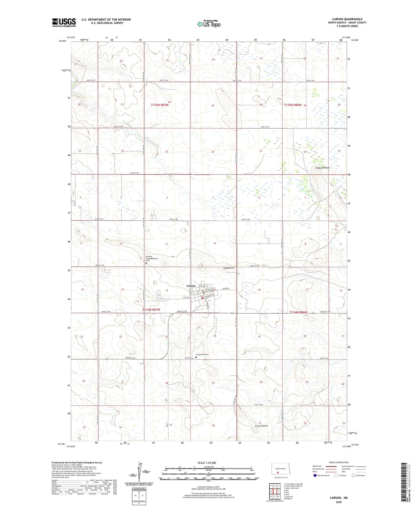
2024 topographic map quadrangle Carson in the state of North Dakota. Scale: 1:24000. Based on the newly updated USGS 7.5' US Topo map series, this map is in the following counties: Grant. The map contains contour data, water features, and other items you are used to seeing on USGS maps, but also has updated roads and other features. This is the next generation of topographic maps. Printed on high-quality waterproof paper with UV fade-resistant inks.
Quads adjacent to this one:
West: Heil
Northwest: Crown Butte Creek SW
North: Crown Butte Creek SE
Northeast: Otter Creek West
East: Lark
Southeast: Brisbane
South: Carson SE
Southwest: Leith
This map covers the same area as the classic USGS quad with code o46101d5.
Contains the following named places: Carson, Carson Ambulance Service, Carson City Hall, Carson Fire Protection District Station, Carson Hill, Carson Post Office, Circle Buttes, City of Carson, Community Cemetery, Cookout Butte, Emmaus Congregational Cemetery, Grant County Courthouse, Grant County Junior High School, Grant County Sheriff's Office, Roosevelt Elementary School