
MyTopo
Cayuga NW North Dakota US Topo Map
Couldn't load pickup availability
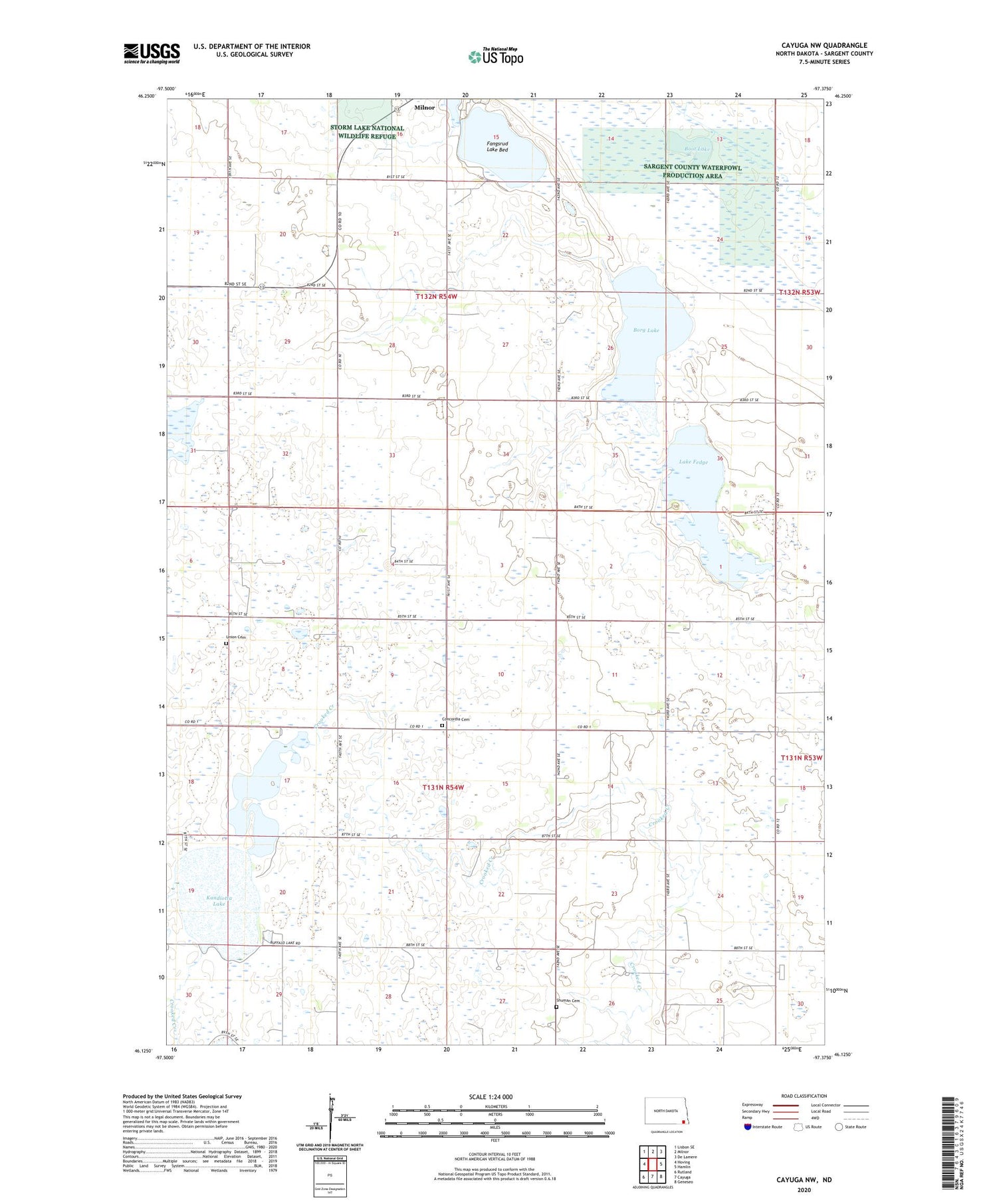
2020 topographic map quadrangle Cayuga NW in the state of North Dakota. Scale: 1:24000. Based on the newly updated USGS 7.5' US Topo map series, this map is in the following counties: Sargent. The map contains contour data, water features, and other items you are used to seeing on USGS maps, but also has updated roads and other features. This is the next generation of topographic maps. Printed on high-quality waterproof paper with UV fade-resistant inks.
Quads adjacent to this one:
West: Hoving
Northwest: Lisbon SE
North: Milnor
Northeast: De Lamere
East: Hamlin
Southeast: Geneseo
South: Cayuga
Southwest: Rutland
Contains the following named places: Boot Lake, Borg Lake, Concordia Cemetery, Concordia Church, Fangsrud Lake Bed, Kandiota Post Office, Kandiotta Lake, Lake Fedge, Sargent County Waterfowl Production Area, School Number 3, Shuman Cemetery, Shuman Town Hall, Township of Highland, Township of Milnor, Township of Shuman, Union Cemetery


