MyTopo
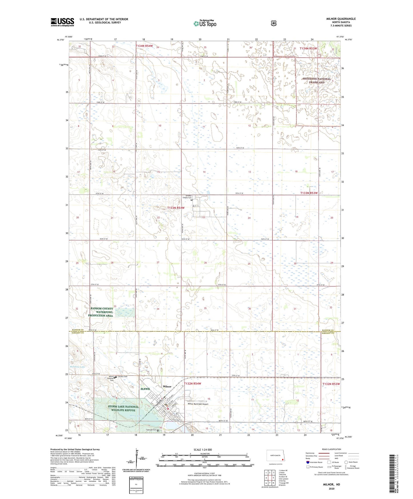
Milnor North Dakota US Topo Map
Couldn't load pickup availability
Also explore the Milnor Forest Service Topo of this same quad for updated USFS data
2024 topographic map quadrangle Milnor in the state of North Dakota. Scale: 1:24000. Based on the newly updated USGS 7.5' US Topo map series, this map is in the following counties: Ransom, Sargent. The map contains contour data, water features, and other items you are used to seeing on USGS maps, but also has updated roads and other features. This is the next generation of topographic maps. Printed on high-quality waterproof paper with UV fade-resistant inks.
Quads adjacent to this one:
West: Lisbon SE
Northwest: Lisbon NE
North: Venlo
Northeast: McLeod
East: De Lamere
Southeast: Hamlin
South: Cayuga NW
Southwest: Hoving
This map covers the same area as the classic USGS quad with code o46097c4.
Contains the following named places: Calvary Cemetery, City of Milnor, Lakeside Cemetery, Milnor, Milnor Area Community Center, Milnor City Hall, Milnor Lutheran Cemetery, Milnor Municipal Airport, Milnor Post Office, Milnor Public School, Milnor Volunteer Fire Station, Sargent County Ambulance Service, Satre Memorial Library, School Number 24, Storm Lake, Storm Lake National Wildlife Refuge, Sundale Colony, Sundale Colony Cemetery, Sundale Colony School, Sydna, Sydna Town Hall, Township of Sydna, ZIP Code: 58060