
MyTopo
Climax NW North Dakota US Topo Map
Couldn't load pickup availability
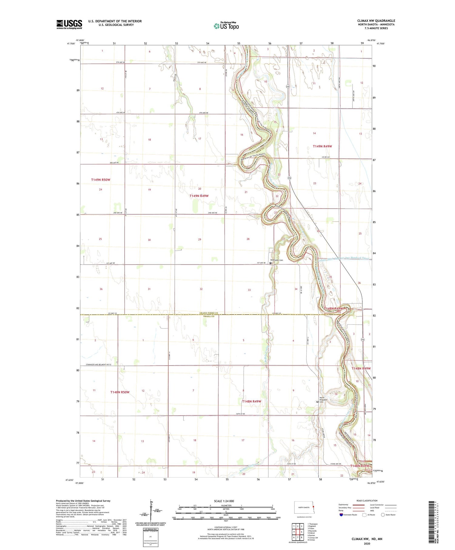
2020 topographic map quadrangle Climax NW in the states of North Dakota, Minnesota. Scale: 1:24000. Based on the newly updated USGS 7.5' US Topo map series, this map is in the following counties: Grand Forks, Traill, Polk. The map contains contour data, water features, and other items you are used to seeing on USGS maps, but also has updated roads and other features. This is the next generation of topographic maps. Printed on high-quality waterproof paper with UV fade-resistant inks.
Quads adjacent to this one:
West: Reynolds
Northwest: Thompson
North: Bygland
Northeast: Fisher
East: Eldred
Southeast: Climax
South: Climax SW
Southwest: Buxton
Contains the following named places: Benton Town Hall, Buffalo Coulee, County Ditch Number Fiftythree, Neby Post Office, North Ringsaker Cemetery, Pioneer Memorial Care Center, Rosendahl Cemetery, Rosendahl Church, Sand Hill Church, Township of Bentru, Township of Tynsid


