
MyTopo
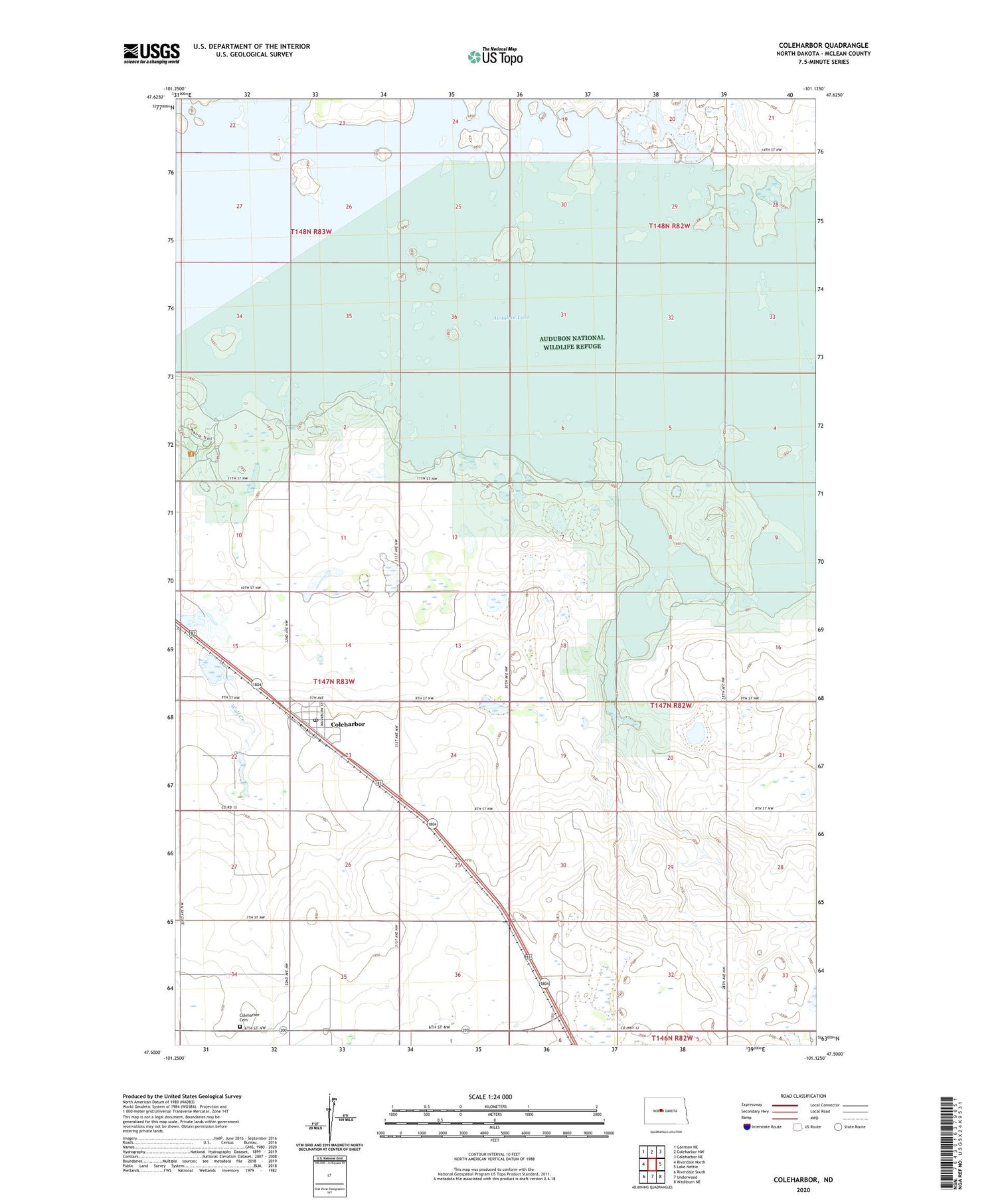
Coleharbor North Dakota US Topo Map
Couldn't load pickup availability
2020 topographic map quadrangle Coleharbor in the state of North Dakota. Scale: 1:24000. Based on the newly updated USGS 7.5' US Topo map series, this map is in the following counties: McLean. The map contains contour data, water features, and other items you are used to seeing on USGS maps, but also has updated roads and other features. This is the next generation of topographic maps. Printed on high-quality waterproof paper with UV fade-resistant inks.
Quads adjacent to this one:
West: Riverdale North
Northwest: Garrison NE
North: Coleharbor NW
Northeast: Coleharbor NE
East: Lake Nettie
Southeast: Washburn NE
South: Underwood
Southwest: Riverdale South
Contains the following named places: Audubon Lake, Audubon National Wildlife Refuge, Audubon State Game Management Area, City of Coleharbor, Coleharbor, Coleharbor Cemetery, Coleharbor Post Office, Coleharbor Water Supply Dam, Gateway, Sacred Heart Mission, Township of Victoria, ZIP Code: 58531


