MyTopo
Crystal North Dakota US Topo Map
Couldn't load pickup availability
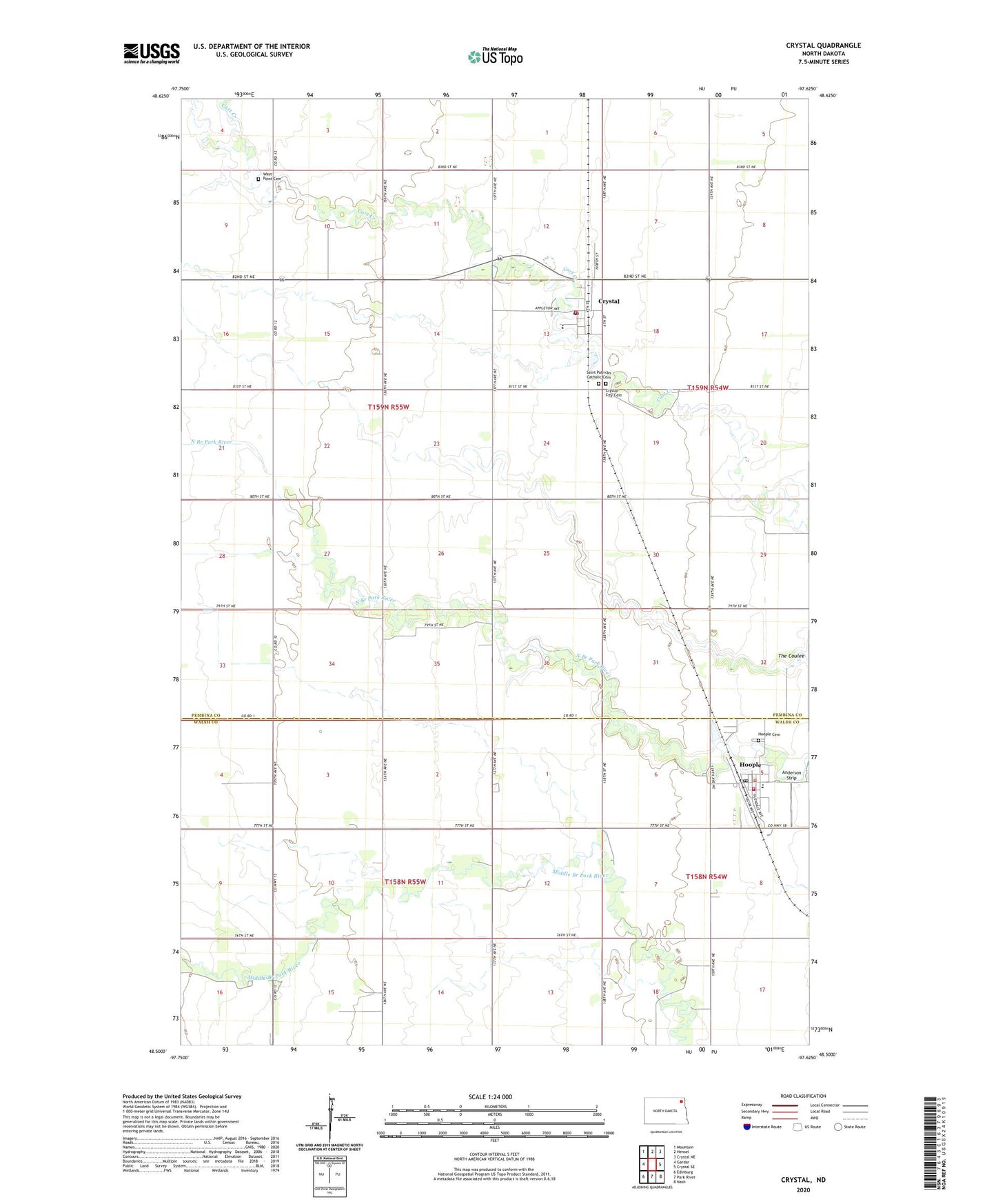
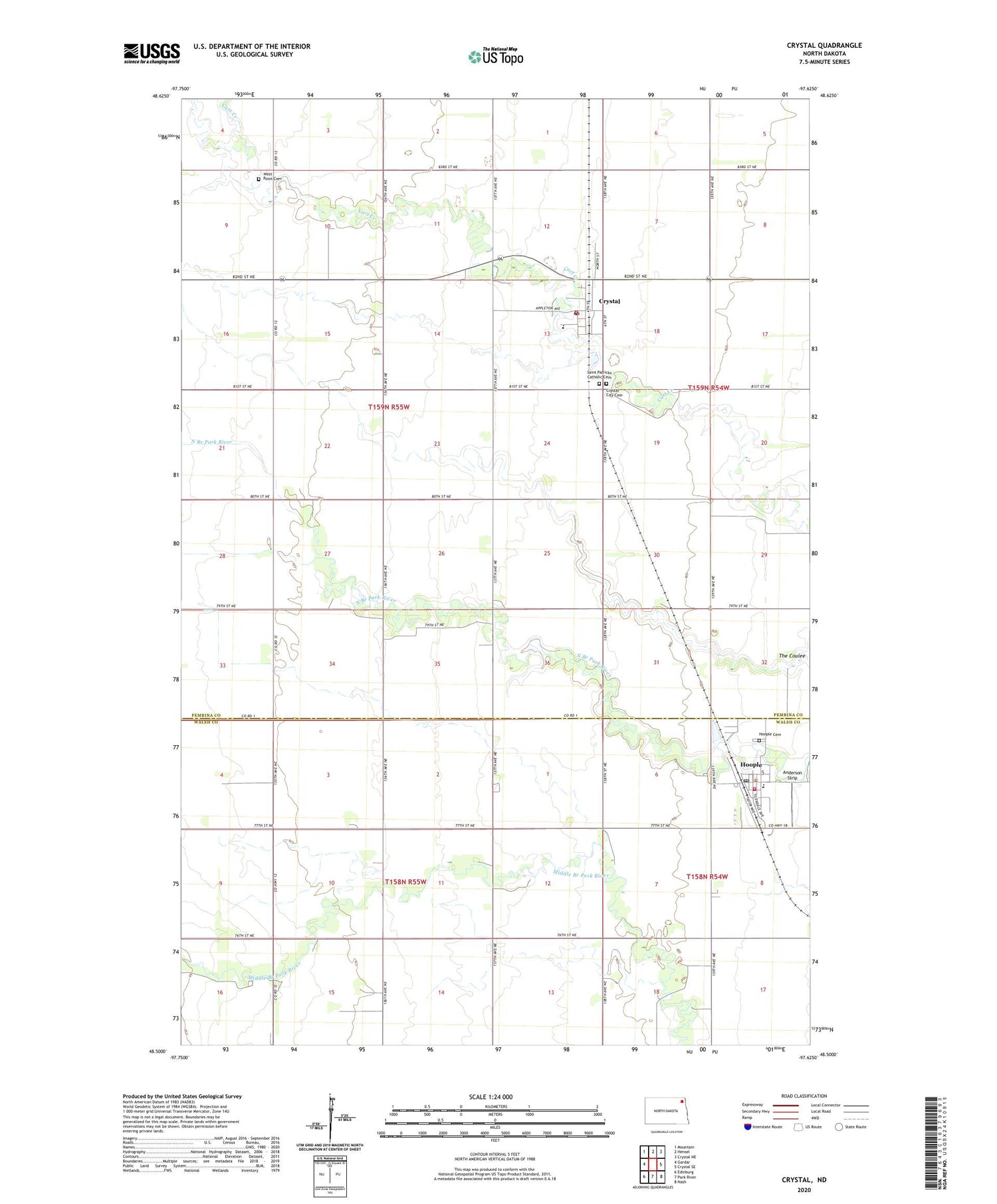
2020 topographic map quadrangle Crystal in the state of North Dakota. Scale: 1:24000. Based on the newly updated USGS 7.5' US Topo map series, this map is in the following counties: Pembina, Walsh. The map contains contour data, water features, and other items you are used to seeing on USGS maps, but also has updated roads and other features. This is the next generation of topographic maps. Printed on high-quality waterproof paper with UV fade-resistant inks.
Quads adjacent to this one:
West: Gardar
Northwest: Mountain
North: Hensel
Northeast: Crystal NE
East: Crystal SE
Southeast: Nash
South: Park River
Southwest: Edinburg
Contains the following named places: Anderson Strip, Augustin Seed Farm, City of Crystal, City of Hoople, Crystal, Crystal City Cemetery, Crystal Dam, Crystal Fire Protection District, Crystal Post Office, Dundee School, Hoople, Hoople Cemetery, Hoople City Hall, Hoople Fire Department, Hoople Post Office, Saint Patricks Catholic Cemetery, Township of Crystal, Valley - Edinburgh Elementary School - Crystal, Valley - Edinburgh Elementary School - Hoople, West Point Cemetery, ZIP Codes: 58222, 58243