MyTopo
Park River North Dakota US Topo Map
Couldn't load pickup availability
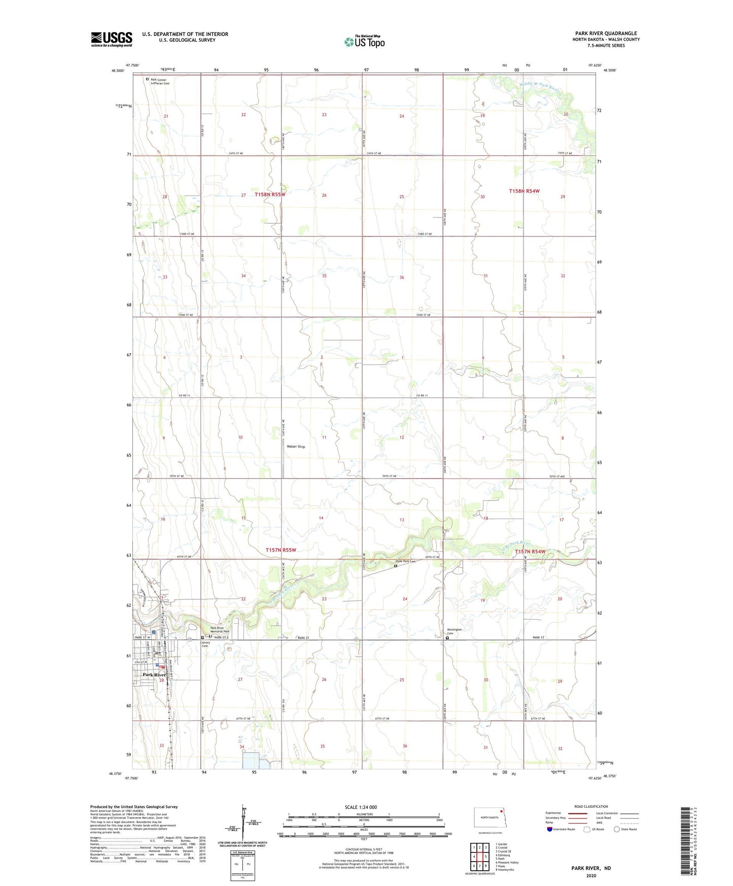
2024 topographic map quadrangle Park River in the state of North Dakota. Scale: 1:24000. Based on the newly updated USGS 7.5' US Topo map series, this map is in the following counties: Walsh. The map contains contour data, water features, and other items you are used to seeing on USGS maps, but also has updated roads and other features. This is the next generation of topographic maps. Printed on high-quality waterproof paper with UV fade-resistant inks.
Quads adjacent to this one:
West: Edinburg
Northwest: Gardar
North: Crystal
Northeast: Crystal SE
East: Nash
Southeast: Veseleyville
South: Pisek
Southwest: Pleasant Valley
This map covers the same area as the classic USGS quad with code o48097d6.
Contains the following named places: Calvary Cemetery, City of Park River, Dundee Town Hall, First Care Health Center, Hyde Park Cemetery, Kensington, Kensington Cemetery, Mount View, Park Center Church, Park Center Lutheran Cemetery, Park River, Park River City Auditorium, Park River City Hall, Park River Fire Department, Park River Memorial Park, Park River Police Department, Park River Post Office, Park River Volunteer Ambulance Service, Township of Dundee, Township of Kensington, Walser Strip