MyTopo
Edinburg North Dakota US Topo Map
Couldn't load pickup availability
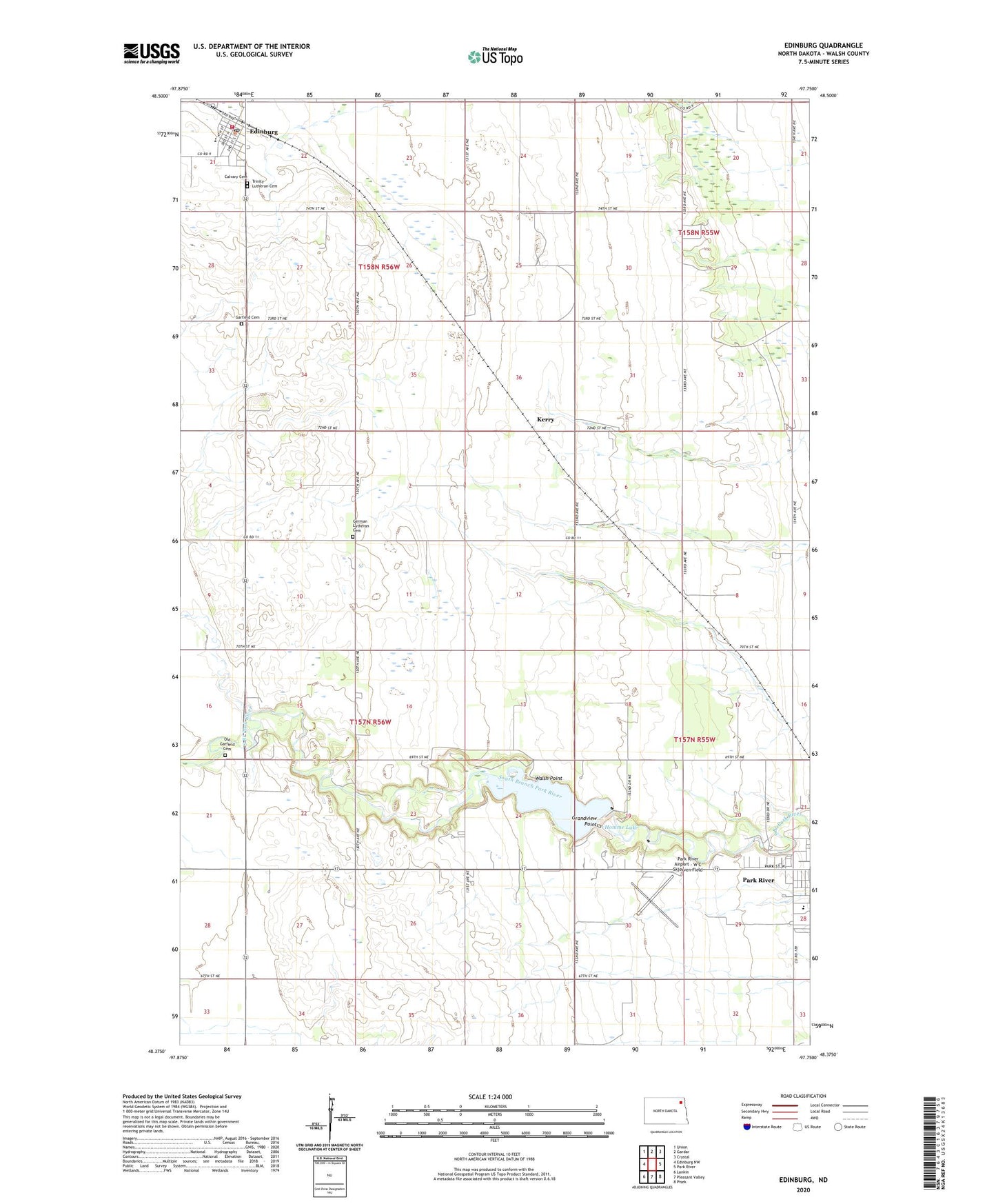
2024 topographic map quadrangle Edinburg in the state of North Dakota. Scale: 1:24000. Based on the newly updated USGS 7.5' US Topo map series, this map is in the following counties: Walsh. The map contains contour data, water features, and other items you are used to seeing on USGS maps, but also has updated roads and other features. This is the next generation of topographic maps. Printed on high-quality waterproof paper with UV fade-resistant inks.
Quads adjacent to this one:
West: Edinburg NW
Northwest: Union
North: Gardar
Northeast: Crystal
East: Park River
Southeast: Pisek
South: Pleasant Valley
Southwest: Lankin
This map covers the same area as the classic USGS quad with code o48097d7.
Contains the following named places: Calvary Cemetery, City of Edinburg, Edinburg, Edinburg City Hall, Edinburg Community Center, Edinburg Fire Protection District, Edinburg Post Office, Garfield, Garfield Cemetery, Garfield Church, German Lutheran Cemetery, Good Samaritan Society-Park River, Grandview Point, Homme Dam, Homme Lake, Kerry, Old Garfield Cemetery, Park River Airport - W C Skjerven Field, Park River Camp, Park River Elementary School, Park River School and Public Library, Township of Garfield, Township of Golden, Township of Lampton, Trinity Lutheran Cemetery, Valley - Edinburg High School, Walsh Point, ZIP Code: 58270