
MyTopo
Cussicks Spring North Dakota US Topo Map
Couldn't load pickup availability
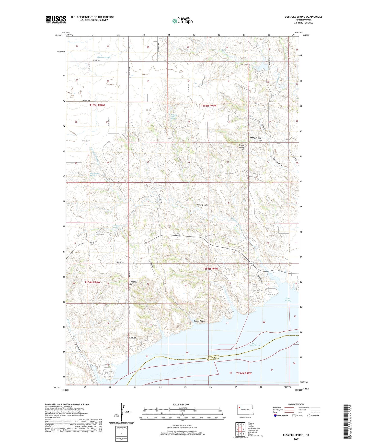
2020 topographic map quadrangle Cussicks Spring in the state of North Dakota. Scale: 1:24000. Based on the newly updated USGS 7.5' US Topo map series, this map is in the following counties: Williams, McKenzie. The map contains contour data, water features, and other items you are used to seeing on USGS maps, but also has updated roads and other features. This is the next generation of topographic maps. Printed on high-quality waterproof paper with UV fade-resistant inks.
Quads adjacent to this one:
West: Gamache Creek
Northwest: Epping
North: Ray
Northeast: Ray SE
East: Red Mike Hill
Southeast: Tobacco Garden Bay
South: Banks
Southwest: Chris Creek
Contains the following named places: Cedar Coulee, Cussicks Spring, Dauers Slough, David Watts Bluff, Flagstaff Hill, Gamache Creek, Hungry Gulch, Hungry Gulch Spring, Kota Ray Dam, Lewis and Clark Recreation Area, Lunds Landing, Mort Adams Spring, Nesson Post Office, North Tobacco Garden State Game Management Area, Ray Dam, Spanish Point, Stone Johnny Coulee, Stone Johnny Hill, Tobacco Garden Creek, Township of Nesson Valley, Township of View, Unorganized Territory of Nesson Valley, White Tail Bay, Wunderlick School


