MyTopo
Ray North Dakota US Topo Map
Couldn't load pickup availability
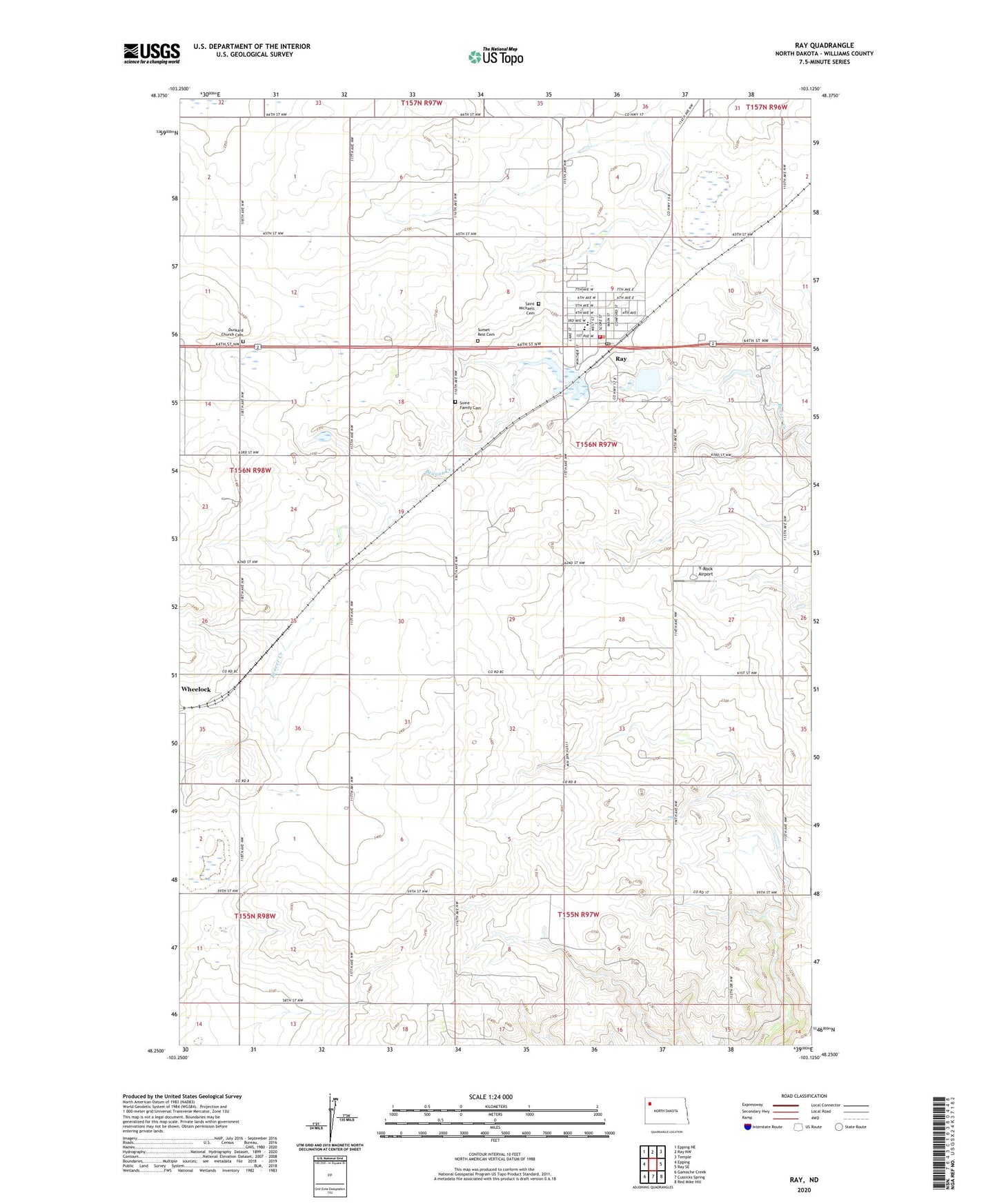
2024 topographic map quadrangle Ray in the state of North Dakota. Scale: 1:24000. Based on the newly updated USGS 7.5' US Topo map series, this map is in the following counties: Williams. The map contains contour data, water features, and other items you are used to seeing on USGS maps, but also has updated roads and other features. This is the next generation of topographic maps. Printed on high-quality waterproof paper with UV fade-resistant inks.
Quads adjacent to this one:
West: Epping
Northwest: Epping NE
North: Ray NW
Northeast: Temple
East: Ray SE
Southeast: Red Mike Hill
South: Cussicks Spring
Southwest: Gamache Creek
This map covers the same area as the classic USGS quad with code o48103c2.
Contains the following named places: City of Ray, Dunkard Church Cemetery, McLedd Lake, McLeod Lake, Ray, Ray City Hall, Ray Fire Protection District Station, Ray Opera House Museum, Ray Post Office, Ray Public School, Ray Railroad Dam, Saint Michaels Cemetery, Soine Family Cemetery, Sunset Rest Cemetery, Township of Equality, Y-Rock Airport, ZIP Code: 58849