MyTopo
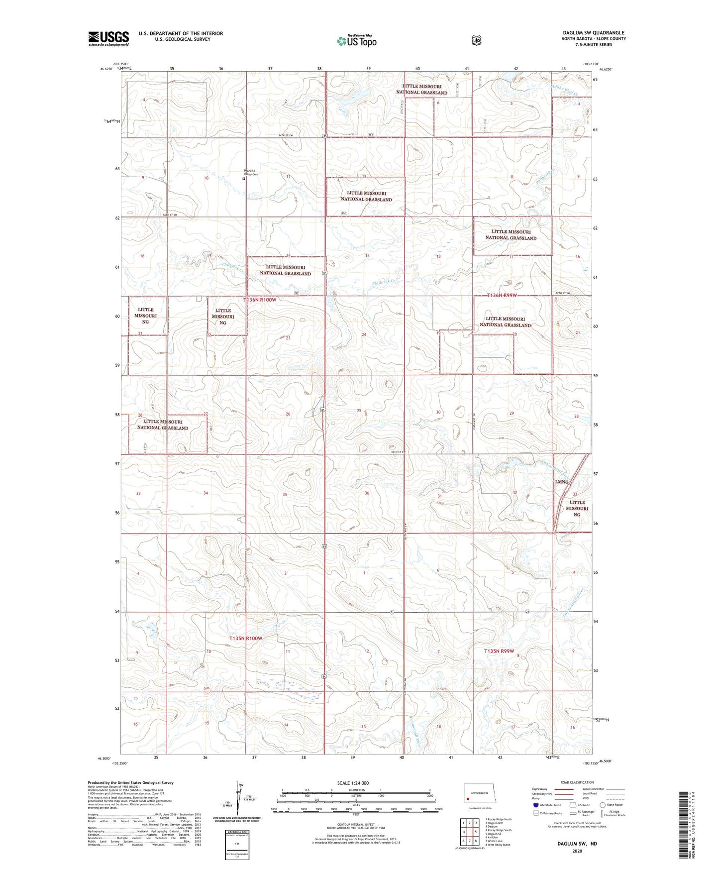
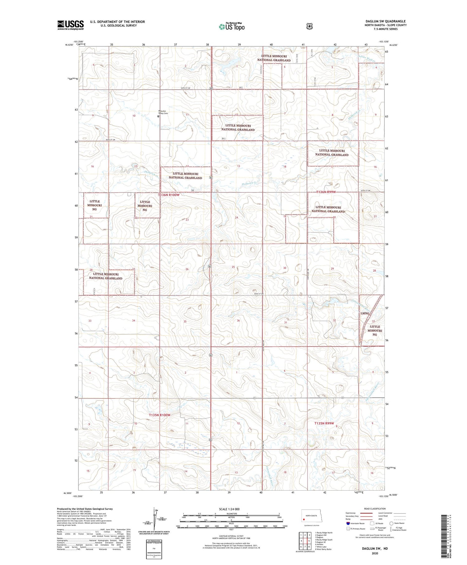
Daglum SW North Dakota US Topo Map
Couldn't load pickup availability
2020 topographic map quadrangle Daglum SW in the state of North Dakota. Scale: 1:24000. Based on the newly updated USGS 7.5' US Topo map series, this map is in the following counties: Slope. The map contains contour data, water features, and other items you are used to seeing on USGS maps, but also has updated roads and other features. This is the next generation of topographic maps. Printed on high-quality waterproof paper with UV fade-resistant inks.
Quads adjacent to this one:
West: Rocky Ridge South
Northwest: Rocky Ridge North
North: Daglum NW
Northeast: Daglum
East: Daglum SE
Southeast: West Rainy Butte
South: White Lake
Southwest: Amidon
Contains the following named places: Adobe Wall Creek, Dovre School Number 1, H Hewson Ranch, H Howie Ranch, Hewson Ranch, Moord School Number 2, Peaceful Valley Cemetery, Peaceful Valley School Number 1, Peaceful Valley School Number 2, Rocky Ridge Oilfield, Schaeffer Ranch, Township of Peaceful Valley