MyTopo
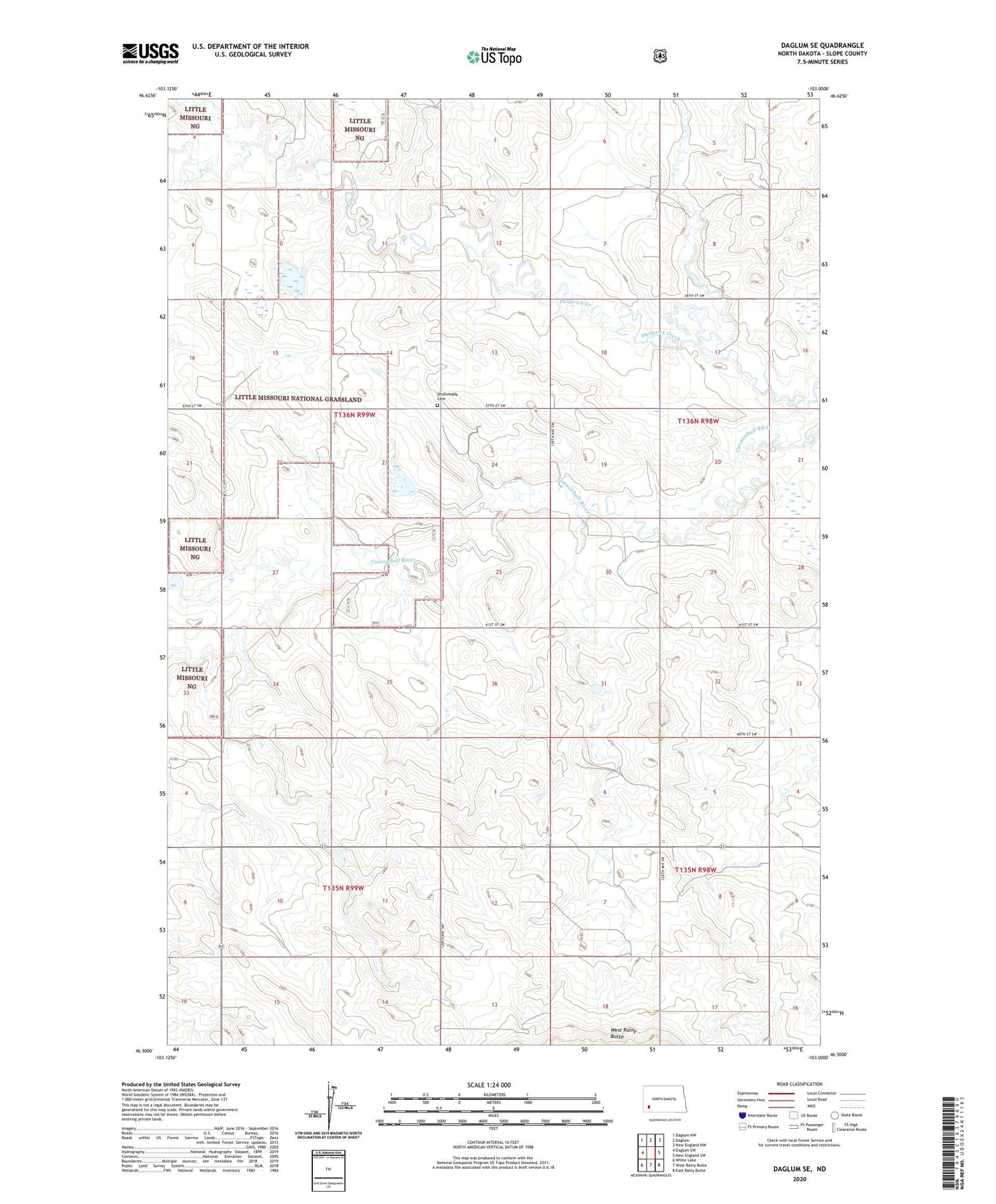
Daglum SE North Dakota US Topo Map
Couldn't load pickup availability
Also explore the Daglum SE Forest Service Topo of this same quad for updated USFS data
2024 topographic map quadrangle Daglum SE in the state of North Dakota. Scale: 1:24000. Based on the newly updated USGS 7.5' US Topo map series, this map is in the following counties: Slope. The map contains contour data, water features, and other items you are used to seeing on USGS maps, but also has updated roads and other features. This is the next generation of topographic maps. Printed on high-quality waterproof paper with UV fade-resistant inks.
Quads adjacent to this one:
West: Daglum SW
Northwest: Daglum NW
North: Daglum
Northeast: New England NW
East: New England SW
Southeast: East Rainy Butte
South: West Rainy Butte
Southwest: White Lake
This map covers the same area as the classic USGS quad with code o46103e1.
Contains the following named places: Dovre Municipal Landing Field, East Six School Number 3, Moord School Number 3, Philbrick Creek, Shollsmade Cemetery, Township of Dovre, Unorganized Territory of Northeast Slope