MyTopo
Daglum NW North Dakota US Topo Map
Couldn't load pickup availability
Also explore the Daglum NW Forest Service Topo of this same quad for updated USFS data
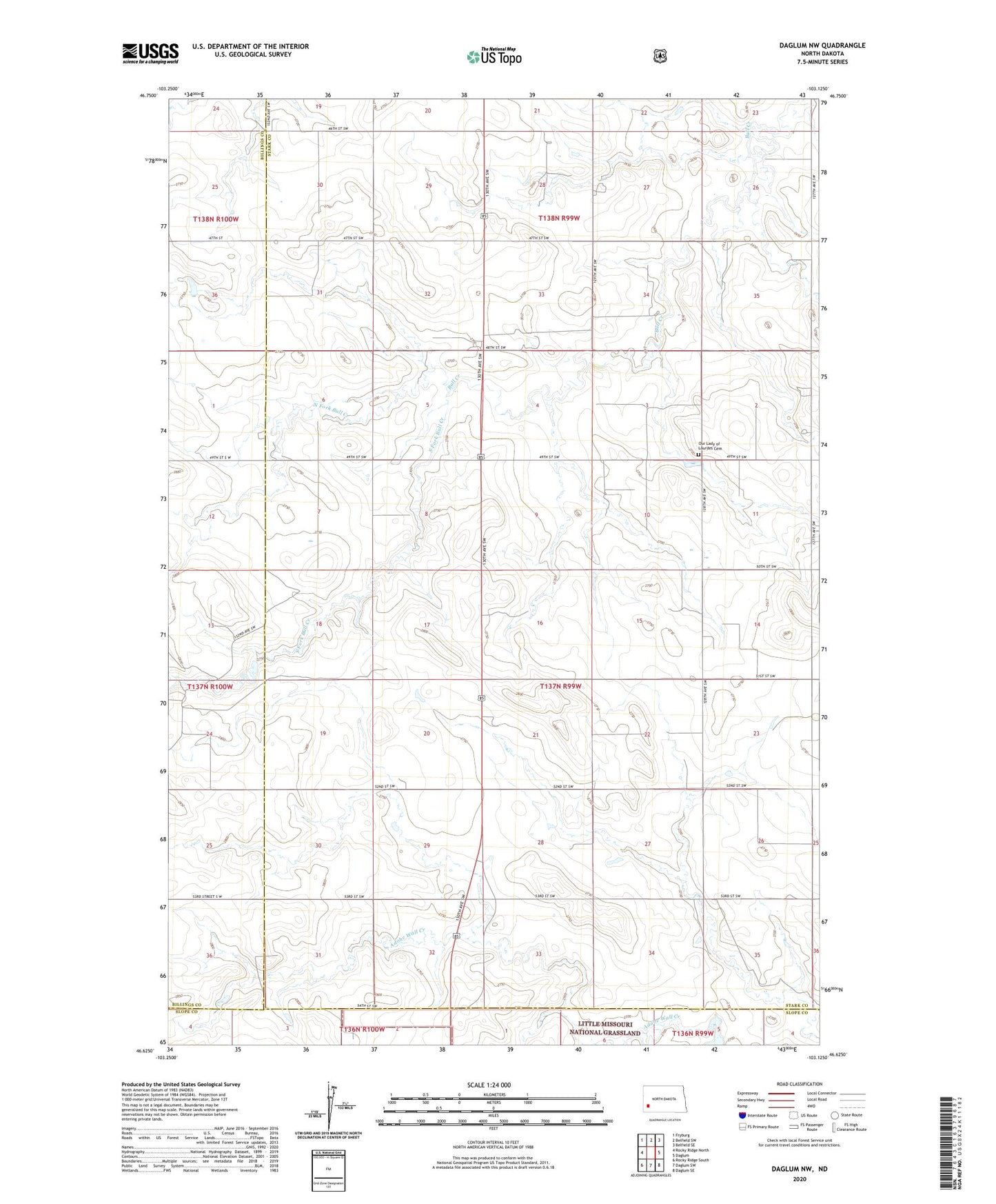
2024 topographic map quadrangle Daglum NW in the state of North Dakota. Scale: 1:24000. Based on the newly updated USGS 7.5' US Topo map series, this map is in the following counties: Stark, Billings, Slope. The map contains contour data, water features, and other items you are used to seeing on USGS maps, but also has updated roads and other features. This is the next generation of topographic maps. Printed on high-quality waterproof paper with UV fade-resistant inks.
Quads adjacent to this one:
West: Rocky Ridge North
Northwest: Fryburg
North: Belfield SW
Northeast: Belfield SE
East: Daglum
Southeast: Daglum SE
South: Daglum SW
Southwest: Rocky Ridge South
This map covers the same area as the classic USGS quad with code o46103f2.
Contains the following named places: Belfield School Number 4, Gaylord, Grand Meadow School Number 1, Grand Meadow School Number 2, Grand Meadow School Number 4, North Fork Bull Creek, Our Lady of Lourdes Cemetery, Our Lady of Lourdes Church, South Fork Bull Creek, Swenson Field, Swenson Ranch