
MyTopo
Des Lacs North Dakota US Topo Map
Couldn't load pickup availability
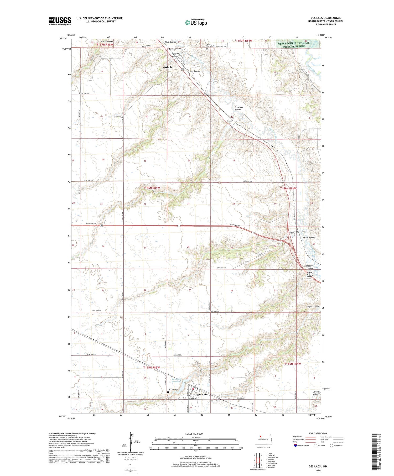
2020 topographic map quadrangle Des Lacs in the state of North Dakota. Scale: 1:24000. Based on the newly updated USGS 7.5' US Topo map series, this map is in the following counties: Ward. The map contains contour data, water features, and other items you are used to seeing on USGS maps, but also has updated roads and other features. This is the next generation of topographic maps. Printed on high-quality waterproof paper with UV fade-resistant inks.
Quads adjacent to this one:
West: Berthold
Northwest: Carpio
North: Carpio NE
Northeast: Burlington NW
East: Burlington
Southeast: Minot NW
South: Mork Lake
Southwest: Rice Lake NW
Contains the following named places: City of Des Lacs, Des Lacs, Des Lacs Cemetery, Des Lacs City Dam, Des Lacs Fire Department, Des Lacs Post Office, Des Lacs Reservoir, Des Lacs-Burlington High School, Foxholm, Foxholm Census Designated Place, Fuller Coulee, Glick Coulee, Kandolph Coulee, Karlsen Coulee, Lonetree Coulee, Reihle Coulee, Saint Marys Cemetery, School Number 3, Tasker Coulee, Township of Foxholm


