MyTopo
Carpio North Dakota US Topo Map
Couldn't load pickup availability
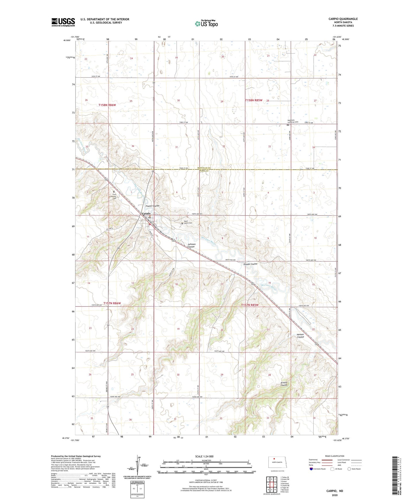
2024 topographic map quadrangle Carpio in the state of North Dakota. Scale: 1:24000. Based on the newly updated USGS 7.5' US Topo map series, this map is in the following counties: Ward, Renville. The map contains contour data, water features, and other items you are used to seeing on USGS maps, but also has updated roads and other features. This is the next generation of topographic maps. Printed on high-quality waterproof paper with UV fade-resistant inks.
Quads adjacent to this one:
West: Hartland
Northwest: Tolley SE
North: Grano SW
Northeast: Grano
East: Carpio NE
Southeast: Des Lacs
South: Berthold
Southwest: Tagus SE
This map covers the same area as the classic USGS quad with code o48101d6.
Contains the following named places: Arnold Coulee, Carpio, Carpio City Hall, Carpio Dam, Carpio Fire Department, Carpio Post Office, City of Carpio, First Lutheran Cemetery, Flaten Coulee, Hanson Coulee, Helseth School, Johnson Coulee, Nazareth Church, Nazareth Lutheran Cemetery, Oleaas Coulee, Saint Johns Cemetery, Skarsbo School, Township of Mayland, Unit 87 Reservoir, Unit 96 Reservoir, ZIP Code: 58725