MyTopo
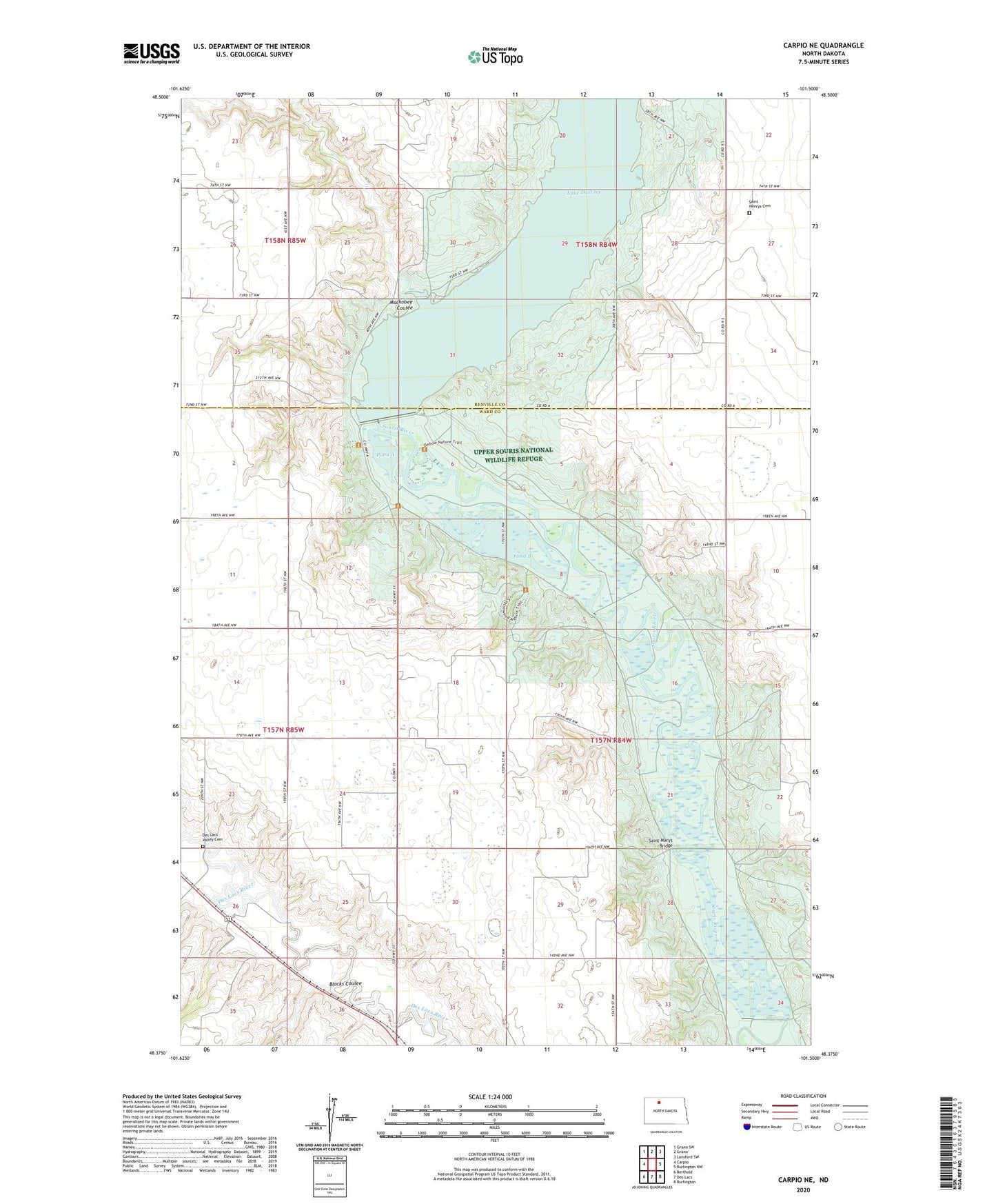
Carpio NE North Dakota US Topo Map
Couldn't load pickup availability
2024 topographic map quadrangle Carpio NE in the state of North Dakota. Scale: 1:24000. Based on the newly updated USGS 7.5' US Topo map series, this map is in the following counties: Ward, Renville. The map contains contour data, water features, and other items you are used to seeing on USGS maps, but also has updated roads and other features. This is the next generation of topographic maps. Printed on high-quality waterproof paper with UV fade-resistant inks.
Quads adjacent to this one:
West: Carpio
Northwest: Grano SW
North: Grano
Northeast: Lansford SW
East: Burlington NW
Southeast: Burlington
South: Des Lacs
Southwest: Berthold
This map covers the same area as the classic USGS quad with code o48101d5.
Contains the following named places: Blacks Coulee, Dam Number 83, Dam Number 87, Dam Number 96, Des Lacs Valley Cemetery, Lake Darling, Mackobee Coulee, Pond A, Pond B, Pond C, Saint Henrys Cemetery, Saint Henrys Church, Saint Marys Bridge, School Number 1, School Number 3, Stamen School Number 1, Township of Saint Marys