MyTopo
Dickey North Dakota US Topo Map
Couldn't load pickup availability
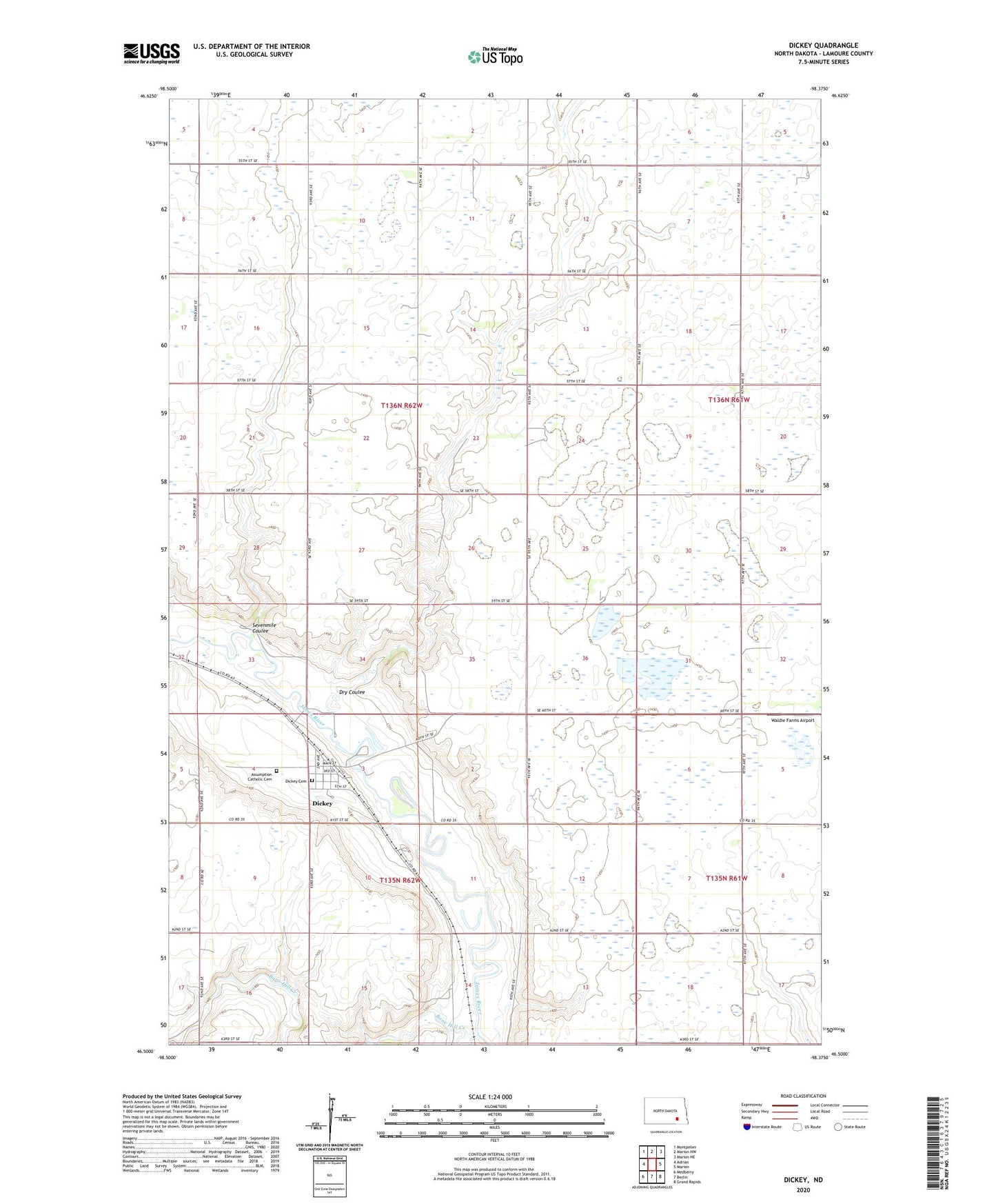
2024 topographic map quadrangle Dickey in the state of North Dakota. Scale: 1:24000. Based on the newly updated USGS 7.5' US Topo map series, this map is in the following counties: LaMoure. The map contains contour data, water features, and other items you are used to seeing on USGS maps, but also has updated roads and other features. This is the next generation of topographic maps. Printed on high-quality waterproof paper with UV fade-resistant inks.
Quads adjacent to this one:
West: Adrian
Northwest: Montpelier
North: Marion NW
Northeast: Marion NE
East: Marion
Southeast: Grand Rapids
South: Berlin
Southwest: Medberry
This map covers the same area as the classic USGS quad with code o46098e4.
Contains the following named places: Assumption Catholic Cemetery, Bone Hill Creek, City of Dickey, Dickey, Dickey Cemetery, Dickey Post Office, Dry Coulee, Saratoga Springs, Saratoga Town Hall, School Number 2, Sevenmile Coulee, Township of Roscoe, Township of Saratoga, ZIP Code: 58431