MyTopo
Englevale North Dakota US Topo Map
Couldn't load pickup availability
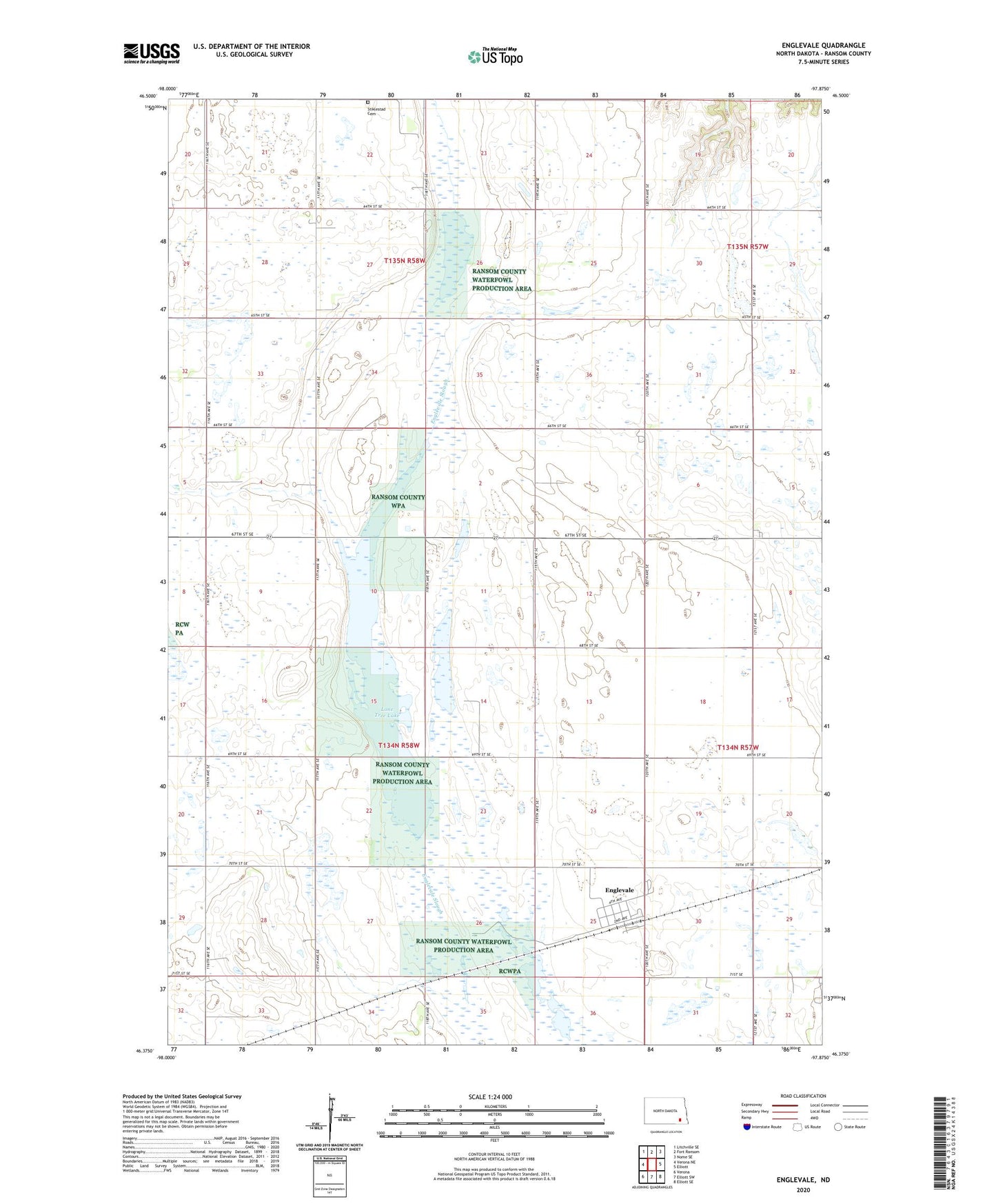
2024 topographic map quadrangle Englevale in the state of North Dakota. Scale: 1:24000. Based on the newly updated USGS 7.5' US Topo map series, this map is in the following counties: Ransom. The map contains contour data, water features, and other items you are used to seeing on USGS maps, but also has updated roads and other features. This is the next generation of topographic maps. Printed on high-quality waterproof paper with UV fade-resistant inks.
Quads adjacent to this one:
West: Verona NE
Northwest: Litchville SE
North: Fort Ransom
Northeast: Nome SE
East: Elliott
Southeast: Elliott SE
South: Elliott SW
Southwest: Verona
This map covers the same area as the classic USGS quad with code o46097d8.
Contains the following named places: Englevale, Englevale Census Designated Place, Lone Tree Lake, Ransom County Waterfowl Production Area, Stiklestad Cemetery, Streich Farm Landing Strip, Township of Fairview, Township of Fort Ransom, Township of Hanson, ZIP Code: 58033