MyTopo
Fillmore North Dakota US Topo Map
Couldn't load pickup availability
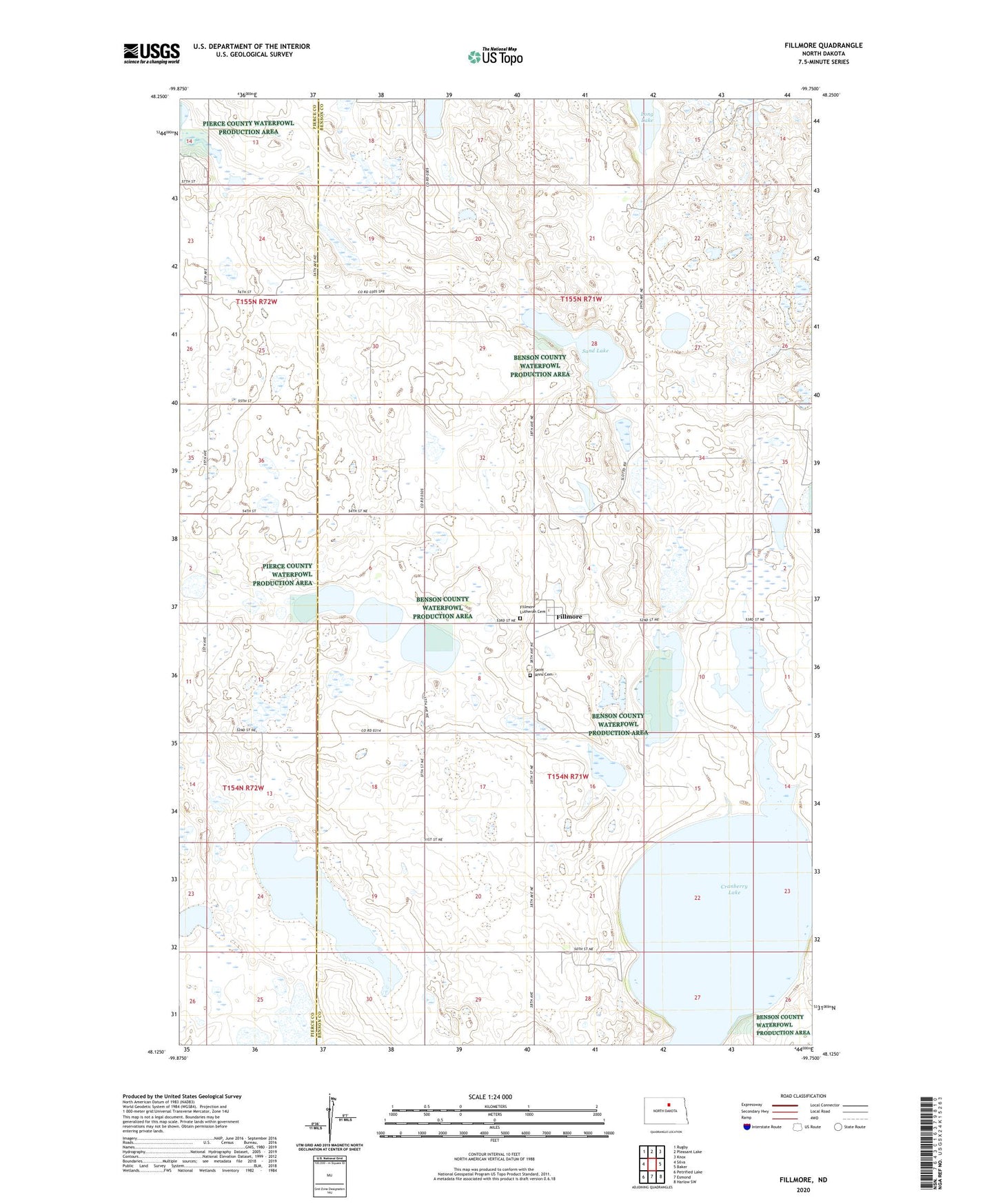
2024 topographic map quadrangle Fillmore in the state of North Dakota. Scale: 1:24000. Based on the newly updated USGS 7.5' US Topo map series, this map is in the following counties: Benson, Pierce. The map contains contour data, water features, and other items you are used to seeing on USGS maps, but also has updated roads and other features. This is the next generation of topographic maps. Printed on high-quality waterproof paper with UV fade-resistant inks.
Quads adjacent to this one:
West: Silva
Northwest: Rugby
North: Pleasant Lake
Northeast: Knox
East: Baker
Southeast: Harlow SW
South: Esmond
Southwest: Petrified Lake
This map covers the same area as the classic USGS quad with code o48099b7.
Contains the following named places: Cranberry Lake, Fillmore, Fillmore Lutheran Cemetery, Saint Anns Cemetery, Sand Lake, Township of Impark, Township of Iowa