MyTopo
Fort Rice North Dakota US Topo Map
Couldn't load pickup availability
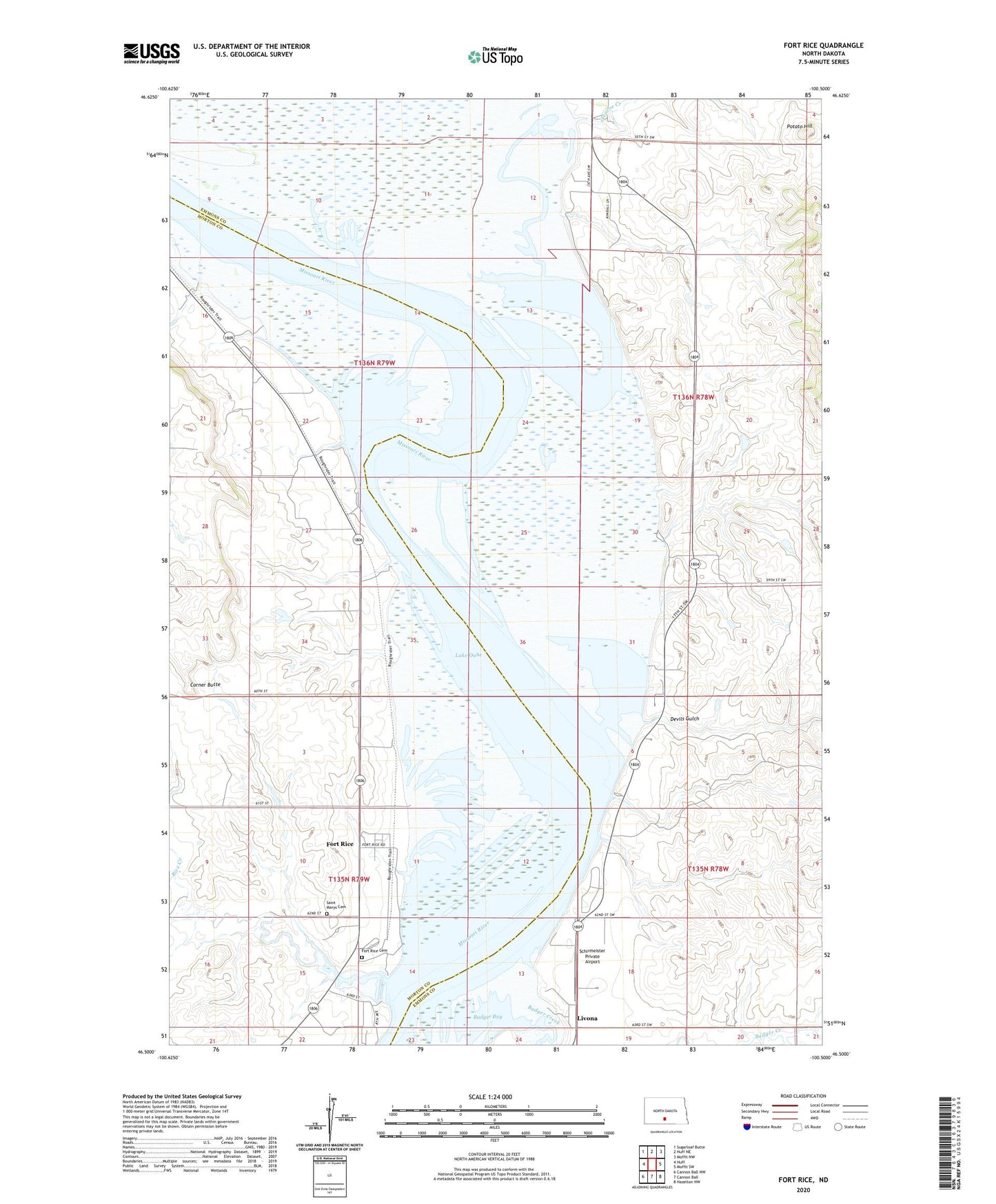
2024 topographic map quadrangle Fort Rice in the state of North Dakota. Scale: 1:24000. Based on the newly updated USGS 7.5' US Topo map series, this map is in the following counties: Emmons, Morton. The map contains contour data, water features, and other items you are used to seeing on USGS maps, but also has updated roads and other features. This is the next generation of topographic maps. Printed on high-quality waterproof paper with UV fade-resistant inks.
Quads adjacent to this one:
West: Huff
Northwest: Sugarloaf Butte
North: Huff NE
Northeast: Moffit NW
East: Moffit SW
Southeast: Hazelton NW
South: Cannon Ball
Southwest: Cannon Ball NW
This map covers the same area as the classic USGS quad with code o46100e5.
Contains the following named places: Badger Bay, Badger Creek, Carlson Lake, Corner Butte, Devils Gulch, Fort Rice, Fort Rice Cemetery, Fort Rice Historical Site, Fort Rice Landing, Fort Rice Recreation Area, Glencoe Creek, Glencoe Post Office, Hazelton Recreation Area, Lake Robinson, Litzman Ponds, Livona, Potato Hill, Rice Creek, Saint Marys Cemetery, Schirmeister Private Airport, Wilde Lake