MyTopo
Fredonia NW North Dakota US Topo Map
Couldn't load pickup availability
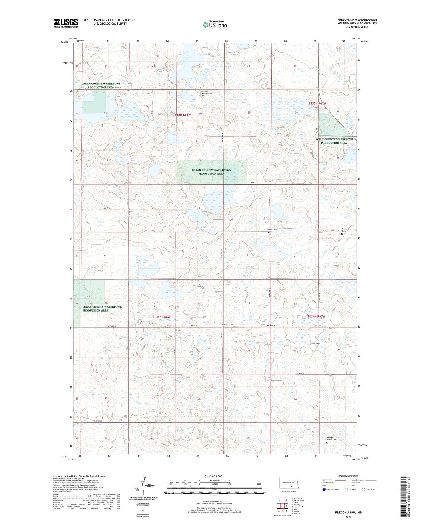
2024 topographic map quadrangle Fredonia NW in the state of North Dakota. Scale: 1:24000. Based on the newly updated USGS 7.5' US Topo map series, this map is in the following counties: Logan. The map contains contour data, water features, and other items you are used to seeing on USGS maps, but also has updated roads and other features. This is the next generation of topographic maps. Printed on high-quality waterproof paper with UV fade-resistant inks.
Quads adjacent to this one:
West: Lehr NE
Northwest: Streeter SE
North: Gackle South
Northeast: Alfred
East: Fredonia NE
Southeast: Fredonia
South: Guyson
Southwest: Lehr
This map covers the same area as the classic USGS quad with code o46099d2.
Contains the following named places: Emmanuel Congregational Cemetery, Eslinger Family Cemetery, Finnish Cemetery, Finnish Church, Friedenthal Cemetery, Gutschmidt Townhall, Labrensz Cemetery, Wolff Cemetery