MyTopo
Glen Ullin North Dakota US Topo Map
Couldn't load pickup availability
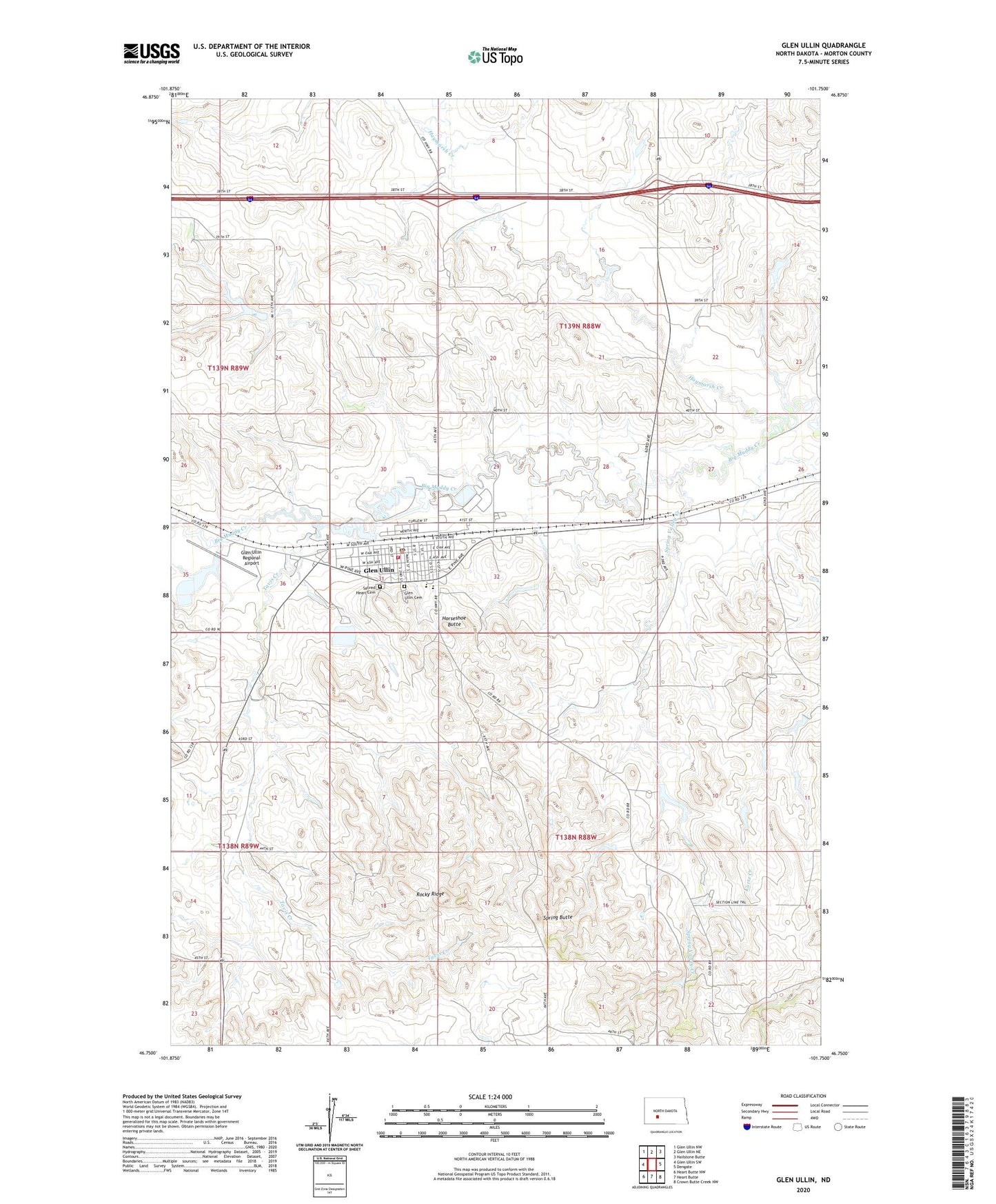
2024 topographic map quadrangle Glen Ullin in the state of North Dakota. Scale: 1:24000. Based on the newly updated USGS 7.5' US Topo map series, this map is in the following counties: Morton. The map contains contour data, water features, and other items you are used to seeing on USGS maps, but also has updated roads and other features. This is the next generation of topographic maps. Printed on high-quality waterproof paper with UV fade-resistant inks.
Quads adjacent to this one:
West: Glen Ullin SW
Northwest: Glen Ullin NW
North: Glen Ullin NE
Northeast: Hailstone Butte
East: Dengate
Southeast: Crown Butte Creek NW
South: Heart Butte
Southwest: Heart Butte NW
This map covers the same area as the classic USGS quad with code o46101g7.
Contains the following named places: City of Glen Ullin, Curlew School Number 3, Glen Ullin, Glen Ullin Ambulance Service, Glen Ullin Cemetery, Glen Ullin City Police Department, Glen Ullin Fire Station, Glen Ullin Municipal Building, Glen Ullin Museum, Glen Ullin Post Office, Glen Ullin Public Library, Glen Ullin Public School, Glen Ullin Railroad Dam, Glen Ullin Regional Airport, Haymarsh Creek, Horseshoe Butte, Marian Manor Healthcare Center, Rocky Ridge, Sacred Heart Cemetery, Schatz Dam, Spring Butte, Spring Valley Creek, Tavis Creek, Tavis School Number 8, ZIP Code: 58631