MyTopo
Gorham North Dakota US Topo Map
Couldn't load pickup availability
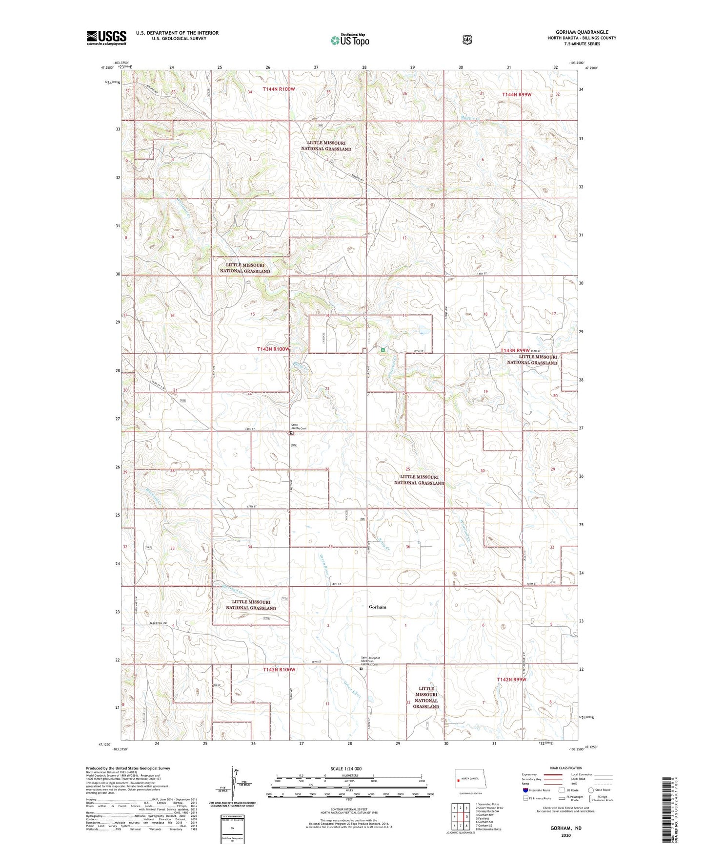
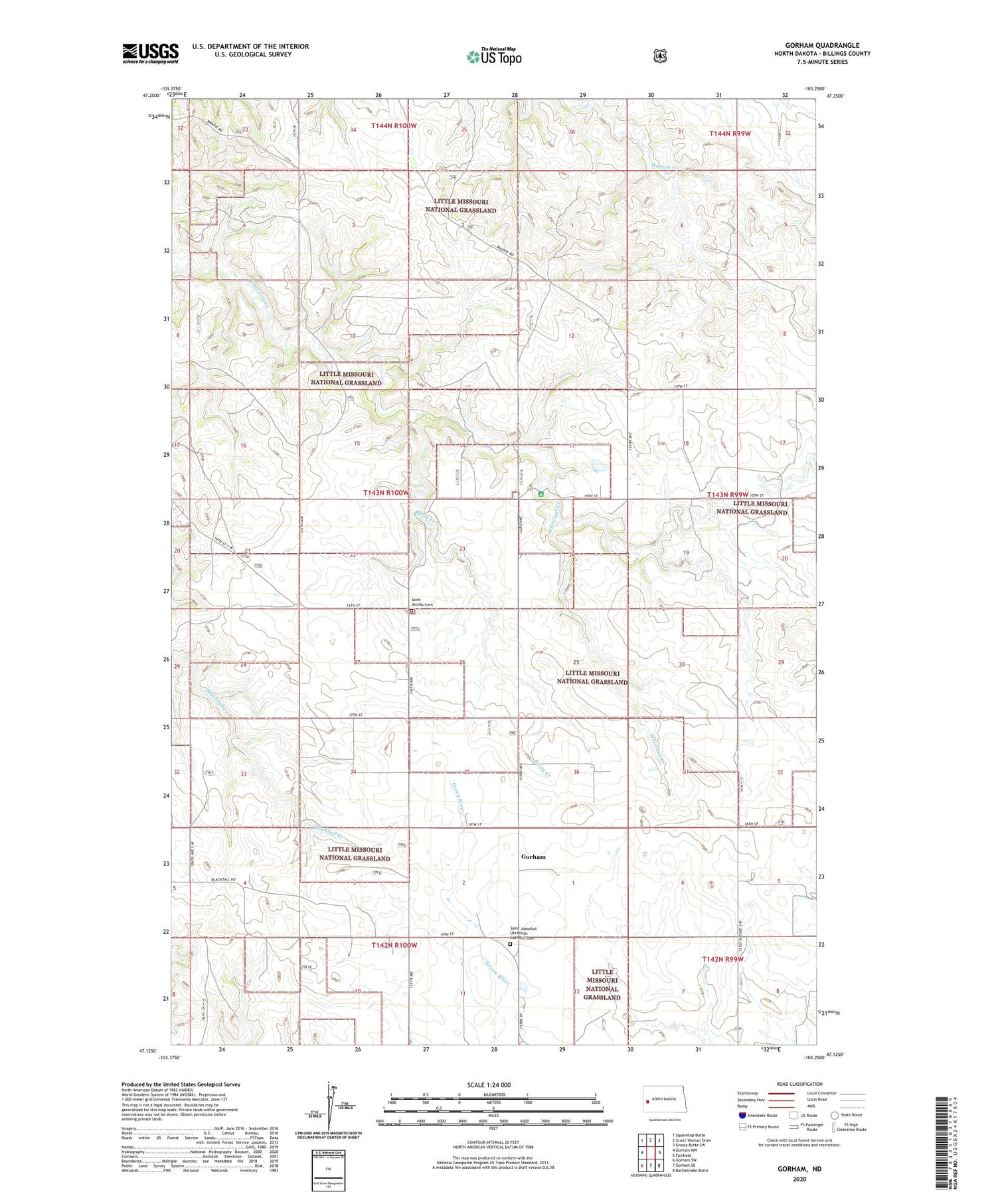
2020 topographic map quadrangle Gorham in the state of North Dakota. Scale: 1:24000. Based on the newly updated USGS 7.5' US Topo map series, this map is in the following counties: Billings. The map contains contour data, water features, and other items you are used to seeing on USGS maps, but also has updated roads and other features. This is the next generation of topographic maps. Printed on high-quality waterproof paper with UV fade-resistant inks.
Quads adjacent to this one:
West: Gorham NW
Northwest: Squaretop Butte
North: Scairt Woman Draw
Northeast: Grassy Butte SW
East: Fairfield
Southeast: Rattlesnake Butte
South: Gorham SE
Southwest: Gorham SW
Contains the following named places: Bassaraba Ranch, Betsy Creek, Chornuk, Evoniuk Ranch, Ewoniuk Ranch, Four Eyes Substation, Gorham, Gorham School Number 4, Haverluk Ranch, Heckler Ranch, Johnson Ranch, Northrup Ranch, Pioneer School Number 1, Pioneer School Number 3, Rodakowski Ranch, Saint Jacobs Cemetery, Saint Josephat Church, Saint Josephat Ukrainian Catholic Cemetery, Stigen Ranch, Unorganized Territory of North Billings, Whitetail Picnic Area, Whitetail School Number 12, Yourk Dam, Yourk Ranch, ZIP Code: 58627