MyTopo
Grace City North Dakota US Topo Map
Couldn't load pickup availability
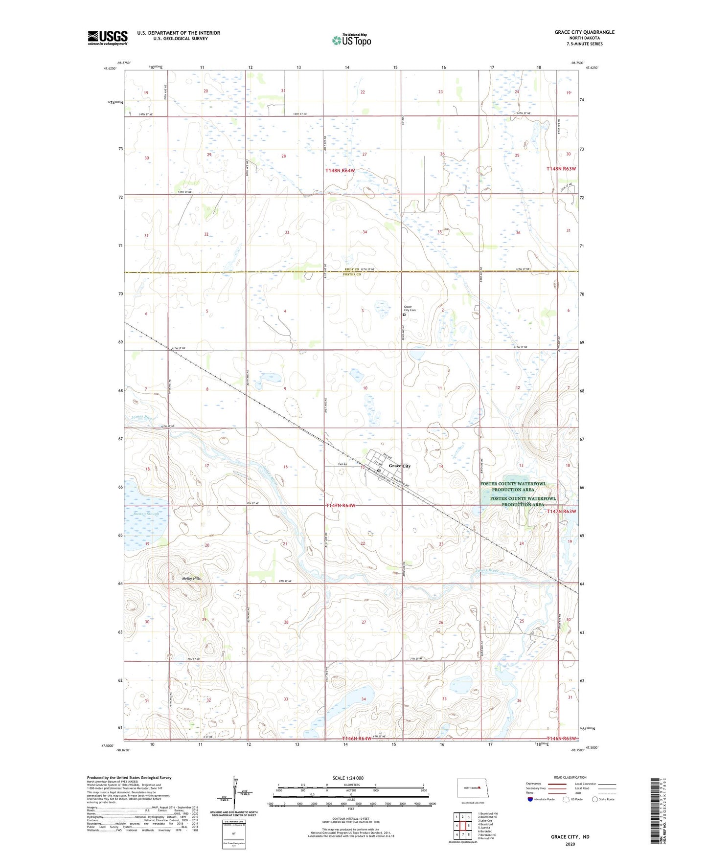
2024 topographic map quadrangle Grace City in the state of North Dakota. Scale: 1:24000. Based on the newly updated USGS 7.5' US Topo map series, this map is in the following counties: Foster, Eddy. The map contains contour data, water features, and other items you are used to seeing on USGS maps, but also has updated roads and other features. This is the next generation of topographic maps. Printed on high-quality waterproof paper with UV fade-resistant inks.
Quads adjacent to this one:
West: Brantford
Northwest: Brantford NW
North: Brantford NE
Northeast: Lake Coe
East: Juanita
Southeast: Kensal NW
South: Bordulac NE
Southwest: Bordulac
This map covers the same area as the classic USGS quad with code o47098e7.
Contains the following named places: Blue Cloud Lake, City of Grace City, Grace City, Grace City Cemetery, Grace City Post Office, Melby Hills, Rusten Slough, Township of Larrabee, ZIP Code: 58445