MyTopo
Hazen East North Dakota US Topo Map
Couldn't load pickup availability
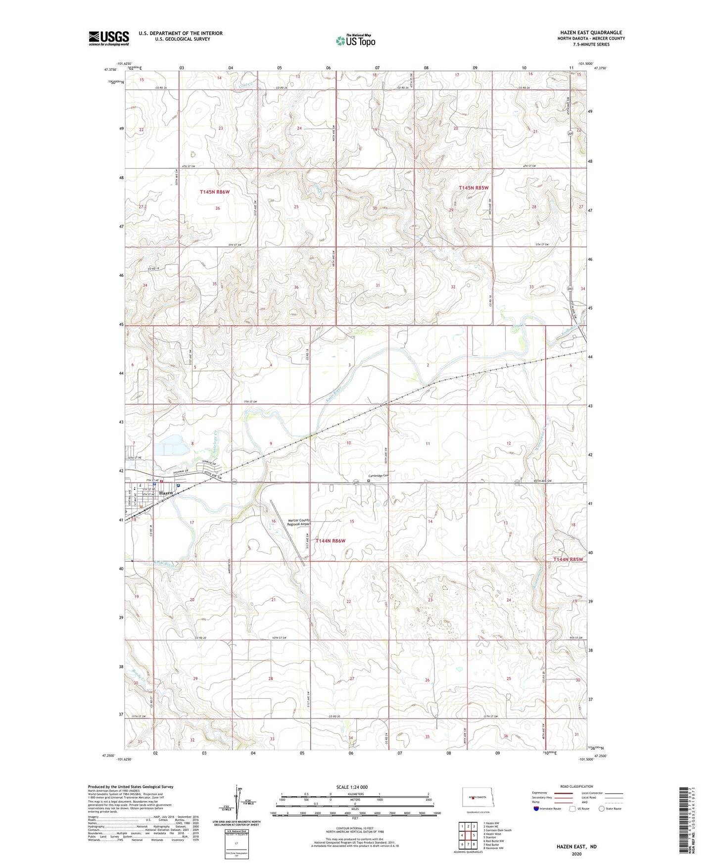
2024 topographic map quadrangle Hazen East in the state of North Dakota. Scale: 1:24000. Based on the newly updated USGS 7.5' US Topo map series, this map is in the following counties: Mercer. The map contains contour data, water features, and other items you are used to seeing on USGS maps, but also has updated roads and other features. This is the next generation of topographic maps. Printed on high-quality waterproof paper with UV fade-resistant inks.
Quads adjacent to this one:
West: Hazen West
Northwest: Hazen NW
North: Hazen NE
Northeast: Garrison Dam South
East: Stanton
Southeast: Hannover NW
South: Red Butte
Southwest: Red Butte NW
This map covers the same area as the classic USGS quad with code o47101c5.
Contains the following named places: Antelope Creek, Cambridge Cemetery, Coal Creek, Hazen, Hazen City Hall, Hazen Elementary School, Hazen Fire Station, Hazen High School, Hazen Middle School, Hazen Police Department, Hazen Post Office, Hazen Public Library, Kinneman Creek, Mercer County Ambulance Service Hazen, Mercer County Regional Airport, Sakakawea Medical Center, ZIP Code: 58545