MyTopo
Hillsboro NW North Dakota US Topo Map
Couldn't load pickup availability
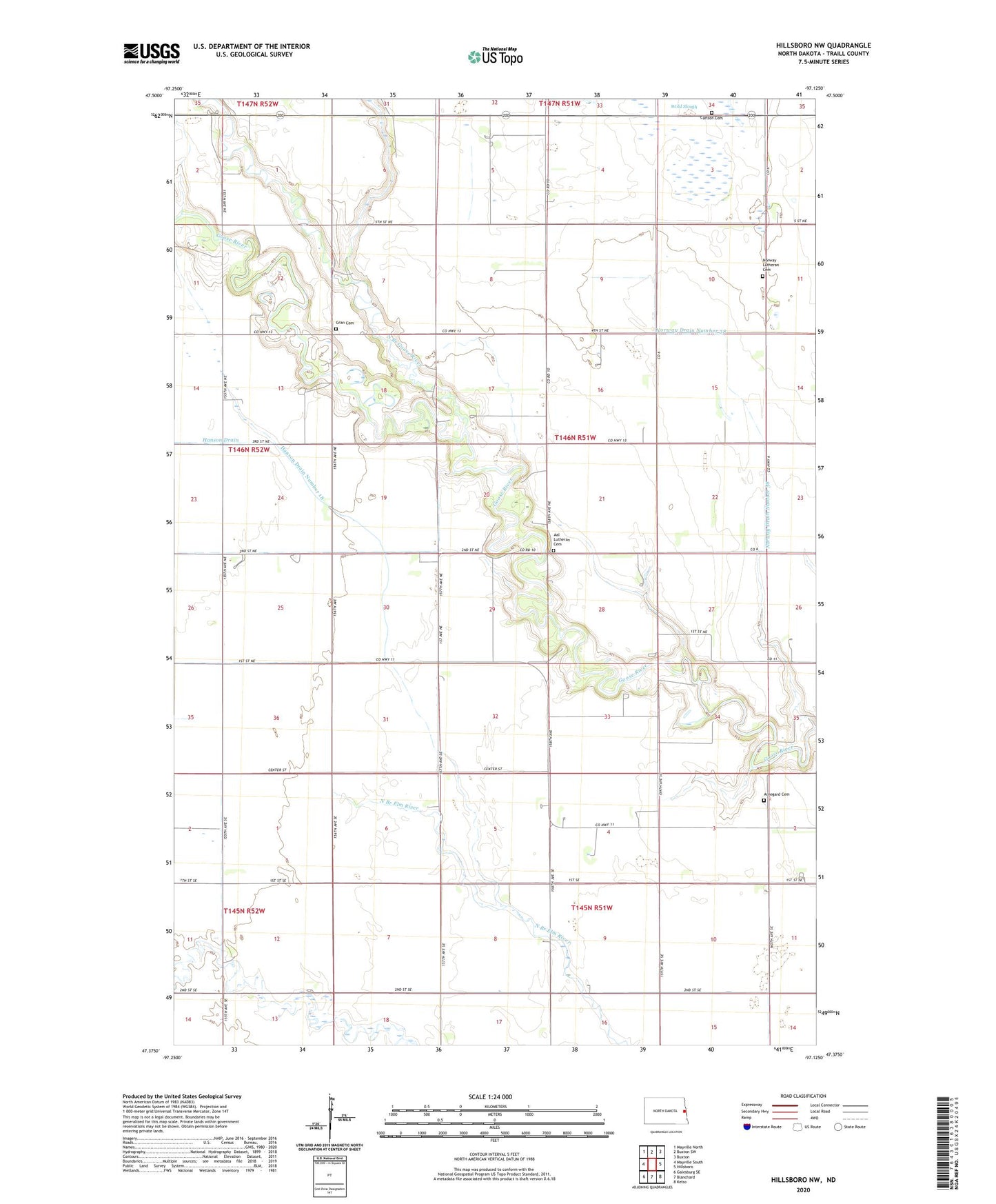
2020 topographic map quadrangle Hillsboro NW in the state of North Dakota. Scale: 1:24000. Based on the newly updated USGS 7.5' US Topo map series, this map is in the following counties: Traill. The map contains contour data, water features, and other items you are used to seeing on USGS maps, but also has updated roads and other features. This is the next generation of topographic maps. Printed on high-quality waterproof paper with UV fade-resistant inks.
Quads adjacent to this one:
West: Mayville South
Northwest: Mayville North
North: Buxton SW
Northeast: Buxton
East: Hillsboro
Southeast: Kelso
South: Blanchard
Southwest: Galesburg SE
Contains the following named places: Aal Church, Aal Lutheran Cemetery, Arnegard Cemetery, Bloomfield Town Hall, Carlson Cemetery, Gran Cemetery, Hanson Drain, Hanson Drain Number 18, Mayville Blanchard Drain, North Branch Goose River, Norway Church, Norway Drain Number 38, Norway Lutheran Cemetery, Norway Town Hall, Township of Norway, Traill County