
MyTopo
Kenmare North Dakota US Topo Map
Couldn't load pickup availability
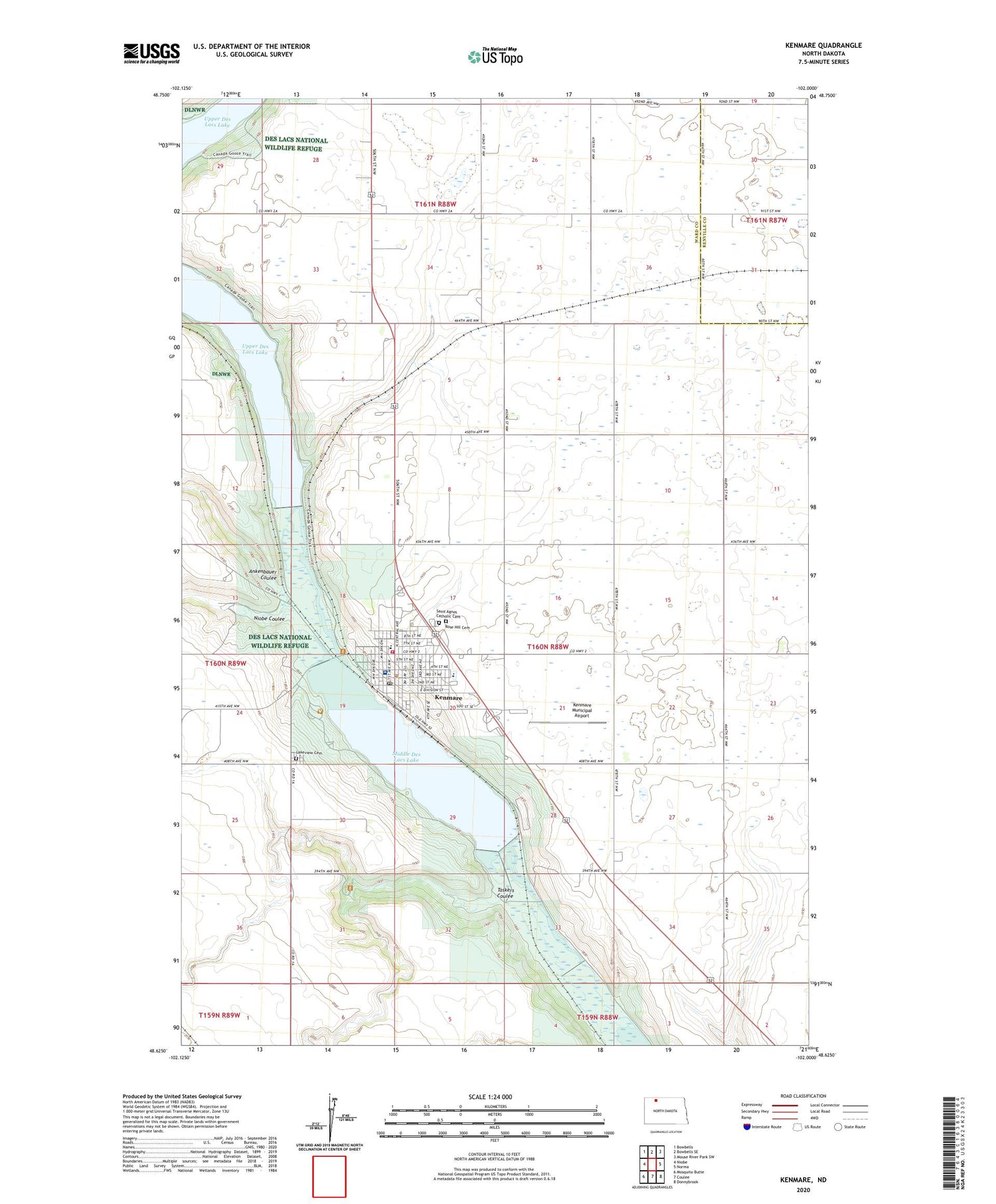
2020 topographic map quadrangle Kenmare in the state of North Dakota. Scale: 1:24000. Based on the newly updated USGS 7.5' US Topo map series, this map is in the following counties: Ward, Renville. The map contains contour data, water features, and other items you are used to seeing on USGS maps, but also has updated roads and other features. This is the next generation of topographic maps. Printed on high-quality waterproof paper with UV fade-resistant inks.
Quads adjacent to this one:
West: Niobe
Northwest: Bowbells
North: Bowbells SE
Northeast: Mouse River Park SW
East: Norma
Southeast: Donnybrook
South: Coulee
Southwest: Mosquito Butte
Contains the following named places: Ankenbauer Coulee, City of Kenmare, Dam Number 2, Dam Number 3, Dam Number 4, Dam Number 4A, Dam Number 6, Danish Mill, Denmark School Number 1, Des Lacs National Wildlife Refuge, Kenmare, Kenmare Branch Library, Kenmare City and Rural Fire Department, Kenmare City Hall, Kenmare City Police Department, Kenmare Elementary School, Kenmare High School, Kenmare Municipal Airport, Kenmare Post Office, Lake County Historical Museum, Lakeview Cemetery, Middle Des Lacs Lake, Niobe Coulee, Pool Three Reservoir, Rose Hill Cemetery, Saint Agnes Catholic Cemetery, Taskers Coulee, Township of Kenmare, Trinity County Hospital, ZIP Code: 58746


