MyTopo
Donnybrook North Dakota US Topo Map
Couldn't load pickup availability
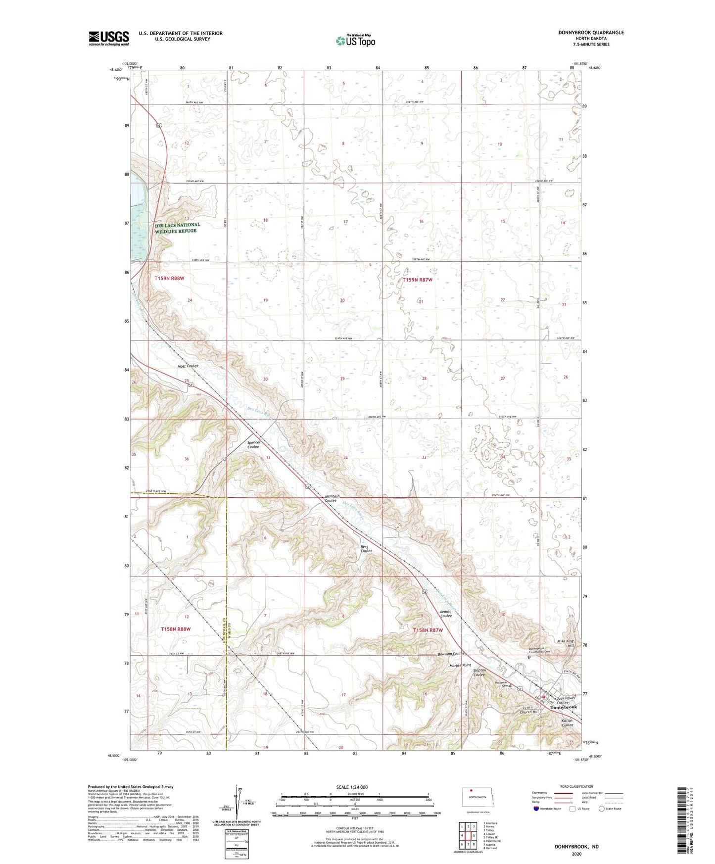
2024 topographic map quadrangle Donnybrook in the state of North Dakota. Scale: 1:24000. Based on the newly updated USGS 7.5' US Topo map series, this map is in the following counties: Ward, Mountrail. The map contains contour data, water features, and other items you are used to seeing on USGS maps, but also has updated roads and other features. This is the next generation of topographic maps. Printed on high-quality waterproof paper with UV fade-resistant inks.
Quads adjacent to this one:
West: Coulee
Northwest: Kenmare
North: Norma
Northeast: Tolley
East: Tolley SE
Southeast: Hartland
South: Aurelia
Southwest: Palermo NE
This map covers the same area as the classic USGS quad with code o48101e8.
Contains the following named places: Aennis Coulee, Berg Coulee, Bowman Coulee, Church Hill, City of Donnybrook, Dam Number 8, Donnybrook, Donnybrook Community Cemetery, Donnybrook Fire Protection District, Donnybrook Post Office, Holbrook Cemetery, Jack Power Coulee, Killian Coulee, Lower Des Lacs Lake, Marble Point, McIntosh Coulee, Mike King Hill, Mott Coulee, School Number 1, School Number 2, School Number 3, School Number 4, Shipton Coulee, Spencer Coulee, Township of Carbondale, Township of Greenbush, ZIP Code: 58734