MyTopo
Kulm North Dakota US Topo Map
Couldn't load pickup availability
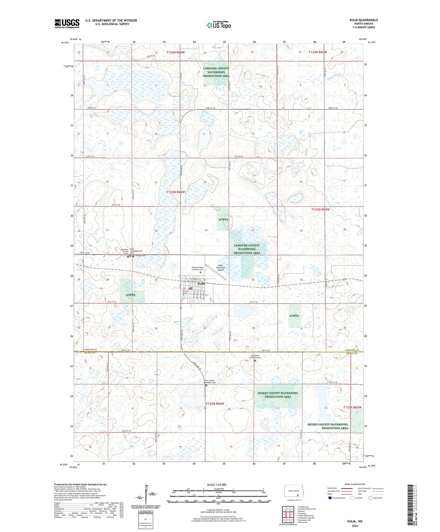
2024 topographic map quadrangle Kulm in the state of North Dakota. Scale: 1:24000. Based on the newly updated USGS 7.5' US Topo map series, this map is in the following counties: LaMoure, Dickey. The map contains contour data, water features, and other items you are used to seeing on USGS maps, but also has updated roads and other features. This is the next generation of topographic maps. Printed on high-quality waterproof paper with UV fade-resistant inks.
Quads adjacent to this one:
West: Fredonia
Northwest: Fredonia NE
North: Schlecht-Weixel Dam
Northeast: Deisem
East: Kulm-Edgeley Dam
Southeast: Merricourt
South: Merricourt NW
Southwest: Coldwater Lake NE
This map covers the same area as the classic USGS quad with code o46098c8.
Contains the following named places: Assembly of God Cemetery, City of Kulm, Hillside Cemetery, Kulm, Kulm Ambulance Corps, Kulm City Hall, Kulm Congregational Cemetery, Kulm Elementary School, Kulm Fire Department, Kulm High School, Kulm Municipal Airport, Kulm Police Department, Kulm Post Office, Pomona Valley Lutheran Cemetery, Pruetz Municipal Airport, Saint Paul's Lutheran Cemetery, Swede Dam, Township of Norden, Zion United Methodist Cemetery, ZIP Code: 58456