MyTopo
Lincoln Valley SW North Dakota US Topo Map
Couldn't load pickup availability
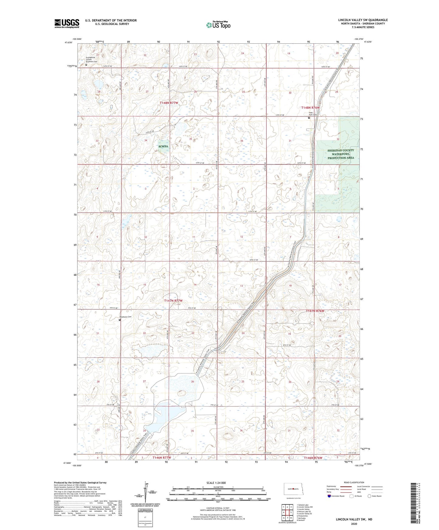
2024 topographic map quadrangle Lincoln Valley SW in the state of North Dakota. Scale: 1:24000. Based on the newly updated USGS 7.5' US Topo map series, this map is in the following counties: Sheridan. The map contains contour data, water features, and other items you are used to seeing on USGS maps, but also has updated roads and other features. This is the next generation of topographic maps. Printed on high-quality waterproof paper with UV fade-resistant inks.
Quads adjacent to this one:
West: Pelican Lake SE
Northwest: Siebold Lake
North: Lincoln Valley NW
Northeast: Lincoln Valley
East: Lincoln Valley SE
Southeast: Denhoff
South: McClusky
Southwest: Pickardville
This map covers the same area as the classic USGS quad with code o47100e4.
Contains the following named places: Evangelical United Brethren Cemetery, Hellman School Number 2, Herr School Number 1, Hieb - Huft Cemetery, Mountain City School Number 1, Reformed Church, Unorganized Territory of Central Sheridan, Westheim Cemetery