MyTopo
Mercer SW North Dakota US Topo Map
Couldn't load pickup availability
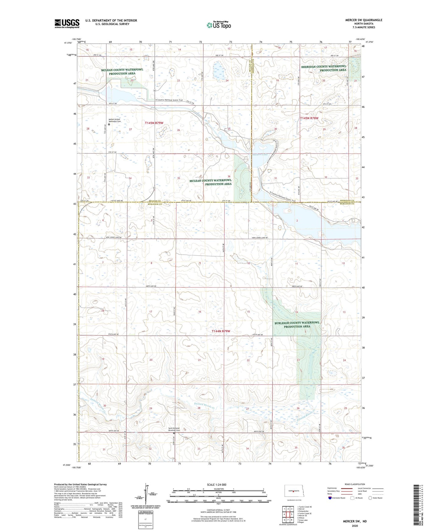
2024 topographic map quadrangle Mercer SW in the state of North Dakota. Scale: 1:24000. Based on the newly updated USGS 7.5' US Topo map series, this map is in the following counties: Burleigh, McLean, Sheridan. The map contains contour data, water features, and other items you are used to seeing on USGS maps, but also has updated roads and other features. This is the next generation of topographic maps. Printed on high-quality waterproof paper with UV fade-resistant inks.
Quads adjacent to this one:
West: Turtle Creek SE
Northwest: Turtle Creek NE
North: Mercer
Northeast: Pickardville
East: Mercer SE
Southeast: Regan
South: Grass Lake
Southwest: Wilton
This map covers the same area as the classic USGS quad with code o47100c6.
Contains the following named places: Bethel United Methodist Cemetery, Heckers Lake, Park School Number 2, Saint Nickolas Ukrainian Cemetery, School Number 1, School Number 2, School Number 5, Township of Wilson