MyTopo
Mosquito Butte North Dakota US Topo Map
Couldn't load pickup availability
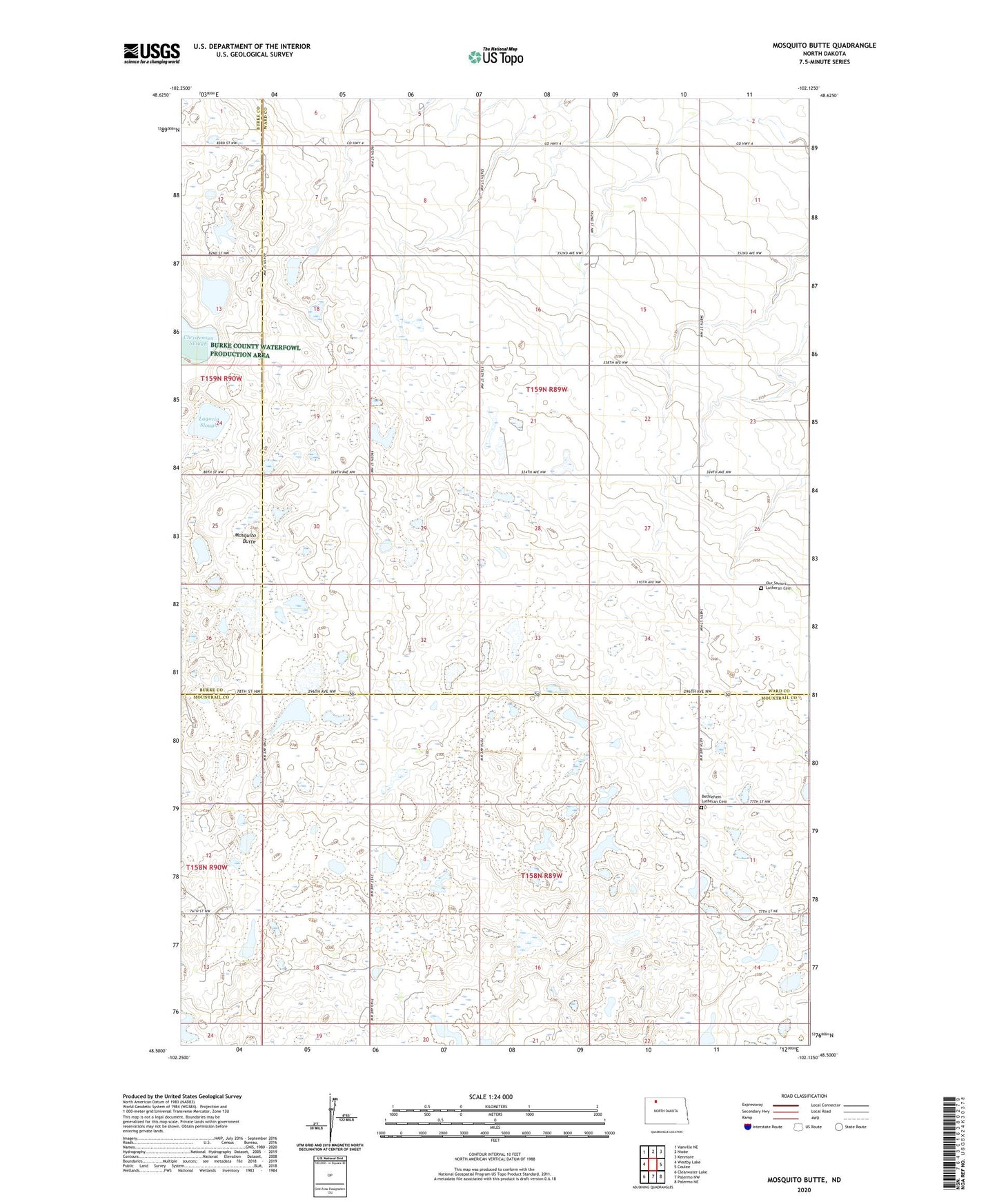
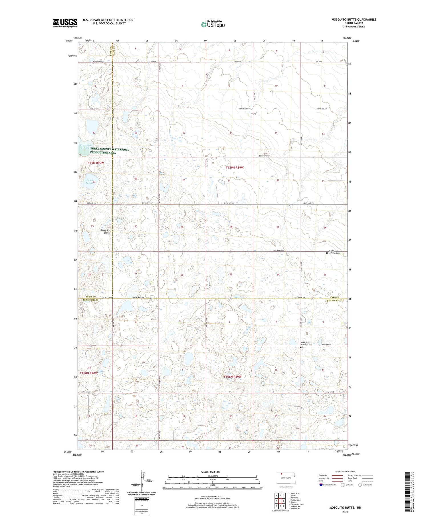
2020 topographic map quadrangle Mosquito Butte in the state of North Dakota. Scale: 1:24000. Based on the newly updated USGS 7.5' US Topo map series, this map is in the following counties: Ward, Mountrail, Burke. The map contains contour data, water features, and other items you are used to seeing on USGS maps, but also has updated roads and other features. This is the next generation of topographic maps. Printed on high-quality waterproof paper with UV fade-resistant inks.
Quads adjacent to this one:
West: Westby Lake
Northwest: Vanville NE
North: Niobe
Northeast: Kenmare
East: Coulee
Southeast: Palermo NE
South: Palermo NW
Southwest: Clearwater Lake
Contains the following named places: Bethlehem Church, Bethlehem Lutheran Cemetery, Buck School, Lagorin Slough, Mosquito Butte, Our Savior Church, Our Saviors Lutheran Cemetery, School Number 2, School Number 3, Township of Crowfoot, Township of Spencer