MyTopo
Vanville NE North Dakota US Topo Map
Couldn't load pickup availability
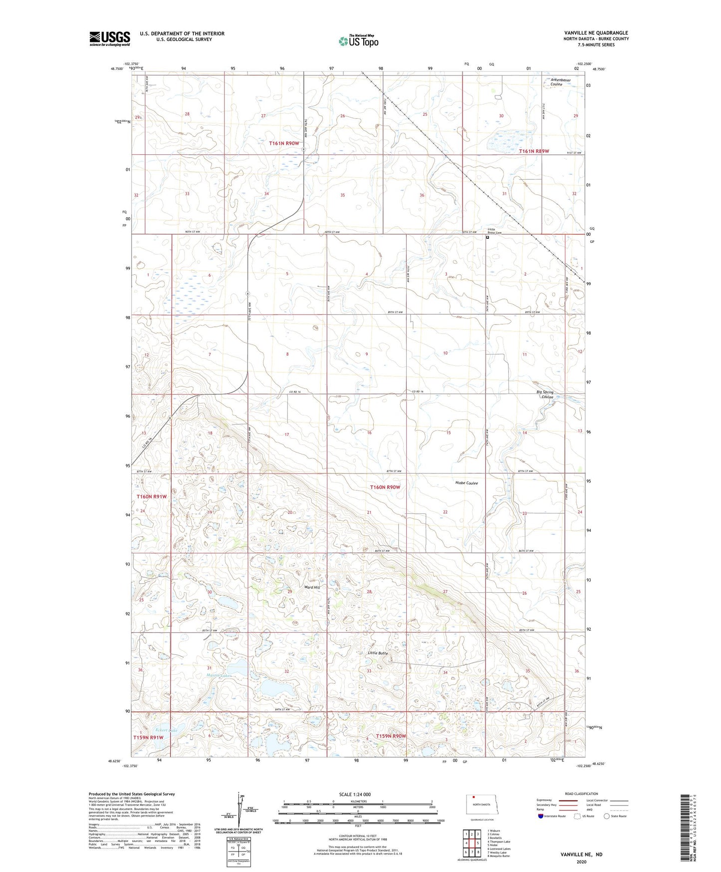
2024 topographic map quadrangle Vanville NE in the state of North Dakota. Scale: 1:24000. Based on the newly updated USGS 7.5' US Topo map series, this map is in the following counties: Burke. The map contains contour data, water features, and other items you are used to seeing on USGS maps, but also has updated roads and other features. This is the next generation of topographic maps. Printed on high-quality waterproof paper with UV fade-resistant inks.
Quads adjacent to this one:
West: Thompson Lake
Northwest: Woburn
North: Coteau
Northeast: Bowbells
East: Niobe
Southeast: Mosquito Butte
South: Westby Lake
Southwest: Lostwood Lakes
This map covers the same area as the classic USGS quad with code o48102f3.
Contains the following named places: Beck School, Big Spring Coulee, Big Spring School, Eckert Lake, Jensen Lake, Little Butte, Little Butte Cemetery, Martin Lakes, Masters School, Township of Roseland, Vanville, Ward Hill