MyTopo
New Rockford North Dakota US Topo Map
Couldn't load pickup availability
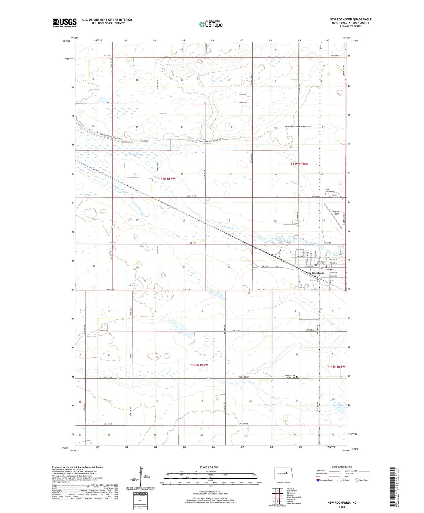
2024 topographic map quadrangle New Rockford in the state of North Dakota. Scale: 1:24000. Based on the newly updated USGS 7.5' US Topo map series, this map is in the following counties: Eddy. The map contains contour data, water features, and other items you are used to seeing on USGS maps, but also has updated roads and other features. This is the next generation of topographic maps. Printed on high-quality waterproof paper with UV fade-resistant inks.
Quads adjacent to this one:
West: Munster
Northwest: Flora SE
North: Oberon SW
Northeast: Sheyenne
East: New Rockford NE
Southeast: New Rockford SE
South: Barlow
Southwest: Cathay SE
This map covers the same area as the classic USGS quad with code o47099f2.
Contains the following named places: City of New Rockford, Eddy County Courthouse, Eddy County Museum, Eddy County Sheriff's Office, Eddy-New Rockford Public Library, German Free Church Cemetery, Lutheran Home of the Good Shepherd, New Rockford, New Rockford City Hall, New Rockford Dam, New Rockford Post Office, New Rockford-Sheyenne Public School, Prairie Home Cemetery, Saint Johns Cemetery, School Number 1, School Number 2, School Number 3, Tomlinson Field, Township of Munster, Township of Rosefield