MyTopo
New Town North Dakota US Topo Map
Couldn't load pickup availability
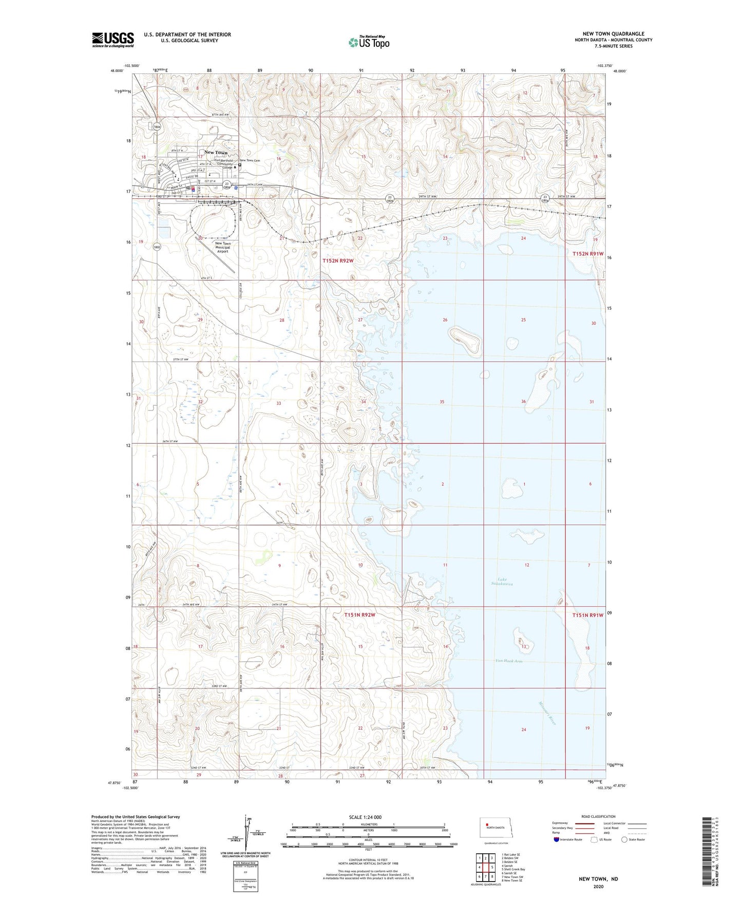
2024 topographic map quadrangle New Town in the state of North Dakota. Scale: 1:24000. Based on the newly updated USGS 7.5' US Topo map series, this map is in the following counties: Mountrail. The map contains contour data, water features, and other items you are used to seeing on USGS maps, but also has updated roads and other features. This is the next generation of topographic maps. Printed on high-quality waterproof paper with UV fade-resistant inks.
Quads adjacent to this one:
West: Sanish
Northwest: Rat Lake SE
North: Belden SW
Northeast: Belden SE
East: Shell Creek Bay
Southeast: New Town SE
South: New Town SW
Southwest: Sanish SE
This map covers the same area as the classic USGS quad with code o47102h4.
Contains the following named places: City of New Town, Edwin Loe Elementary School, Fort Berthold Community College, Fort Berthold Community College Library, New Town, New Town Ambulance Service, New Town Cemetery, New Town Civic Center, New Town Fire Department, New Town High School, New Town Municipal Airport, New Town Police Department, New Town Post Office, New Town Public Library, Shell Creek Segment, Township of Howie, Township of Osborn